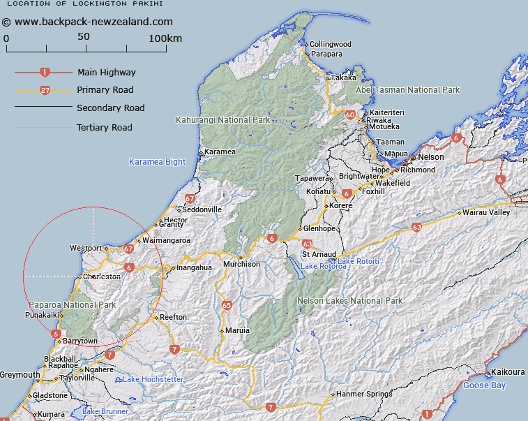
Map showing location of Lockington Pakihi


LINZ description: Open flat area near little Totara River, 6.5km East of Charleston locality. Block VII Waitakere Survey District.
Latitude: -41.899593
Longitude: 171.511128
Northing: 5360300
Easting: 1476500
Land District: Nelson
Feat Type: Area


Scroll down to see a more detailed road map and below that a topographical map showing the location of Lockington Pakihi. The road map has been supplied by openstreetmap and the topographical map of Lockington Pakihi has been supplied by Land Information New Zealand (LINZ).

Yes you can use the top static map for you school/university project or personal website with a link back. Contact me for any commercial use.

Lockington Pakihi Map New Zealand


New Zealand places in our database
[ A ] [ B ] [ C ] [ D ] [ E ] [ F ] [ G ] [ H ] [ I ] [ J ] [ K ] [ L ] [ M ] [ N ] [ O ] [ P ] [ Q ] [ R ] [ S ] [ T ] [ U ] [ V ] [ W ] [ X ] [ Y ] [ Z ]


Closest 20 Areas to Lockington Pakihi

Lockington Pakihi ( 0km )   Welshman Pakihi ( 40.33km )   Dublin Terrace ( 47.33km )   Calf Paddock ( 77.41km )   Gunner Downs ( 111.71km )   Paddys Bend ( 125.92km )   Logans Mistake ( 131.05km )   Little Den ( 136.28km )   Beathams Clearing ( 146.07km )   Amuri Plain ( 148.52km )   Waiau Irrigation Scheme ( 148.54km )   Taylors Camp ( 150.93km )   Pikikirunga / Canaan Downs ( 156.83km )   Moa Park ( 160.13km )   Devils Dining Table ( 164.3km )   Smokers Hole ( 170.54km )   Bush Basin ( 176.2km )   Templars Islands ( 192.19km )   Templers Islands ( 192.19km )   Kangaroo Corner ( 192.2km )   Brabazon Downs ( 197.41km )   Butler Downs ( 204.11km )   Haldon Downs ( 290.81km )   Collier Downs ( 302.71km )   Sams Basin ( 322.81km )   Jumboland ( 334.98km )   Otago Central ( 410.56km )   Central Otago ( 410.56km )   Leitchs Clearing ( 474.98km )   Hipaua Thermal Area ( 484.35km )   The Catlins ( 532.86km )   Maioro ( 575.29km )   East Coast Bays ( 638.48km )   Crosbies Settlement ( 643.94km )