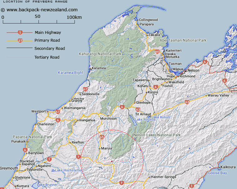
Map showing location of Freyberg Range


LINZ description: North of Lewis Pass and above Maruia River
Latitude: -42.337131
Longitude: 172.3712
Northing: 5312600
Easting: 1548200
Land District: Nelson
Feat Type: Range


Scroll down to see a more detailed road map and below that a topographical map showing the location of Freyberg Range. The road map has been supplied by openstreetmap and the topographical map of Freyberg Range has been supplied by Land Information New Zealand (LINZ).

Yes you can use the top static map for you school/university project or personal website with a link back. Contact me for any commercial use.

Freyberg Range Map New Zealand


New Zealand places in our database
[ A ] [ B ] [ C ] [ D ] [ E ] [ F ] [ G ] [ H ] [ I ] [ J ] [ K ] [ L ] [ M ] [ N ] [ O ] [ P ] [ Q ] [ R ] [ S ] [ T ] [ U ] [ V ] [ W ] [ X ] [ Y ] [ Z ]


Closest 20 Ranges to Freyberg Range

Spenser Range ( 8.09km )   Opera Range ( 8.21km )   Libretto Range ( 12.18km )   Sylvia Tops ( 15.96km )   Poplars Range ( 22.42km )   Doubtful Range ( 26.55km )   St James Range ( 29.02km )   The Dreadnought ( 29.27km )   Ella Range ( 32.75km )   Glynn Wye Range ( 36.99km )   The Nelson Tops ( 37.96km )   Crimea Range ( 39.79km )   Organ Range ( 39.95km )   Tekoa Range ( 41.72km )   Mahanga Range ( 41.86km )   St Arnaud Range ( 42.77km )   Victoria Range ( 43.03km )   Hanmer Range ( 43.16km )   The Brothers ( 44.64km )   The Little Island Hills ( 44.92km )   Culverden Range ( 45.8km )   The Big Island Hills ( 46.68km )   The Sisters ( 47.94km )   Boddington Range ( 48.34km )   Crawford Range ( 49.44km )   The Braes ( 50.07km )   The Hooligan ( 52.21km )   Oronoko Range ( 52.33km )   Studleigh Range ( 54.28km )   Travers Range ( 57.03km )   Brunner Range ( 57.81km )   Dampier Range ( 59.06km )   Muntz Range ( 61.29km )   Cavendish Hills ( 62.41km )   Rachel Range ( 63.19km )   The Candlesticks ( 65.01km )   Amuri Range ( 65.56km )   Braeburn Range ( 66.11km )   Old Man Hills ( 66.2km )   Snow Cup Range ( 68.96km )