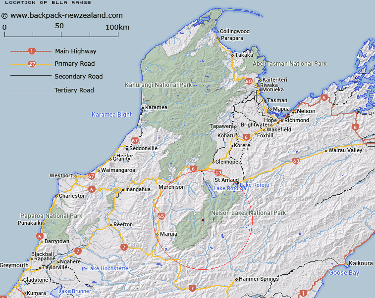
Map showing location of Ella Range
LINZ description: Range of peaks running southward from the lower Tiraumea Saddle, 1.5km South of Mount Hutton [Trig. O (Geodetic Code A5AJ)], through Mounts Watson, Ella (Geodetic Code 1427), and Magdalene to the junction with Spenser Mountains, South-east of D'Urville Pass. Rotoroa and Sabine Survey Districts.
Latitude: -42.082382
Longitude: 172.570793
Northing: 5340987.8
Easting: 1564499.9
Land District: Nelson
Feat Type: Range
Latitude: -42.082382
Longitude: 172.570793
Northing: 5340987.8
Easting: 1564499.9
Land District: Nelson
Feat Type: Range

Scroll down to see a more detailed road map and below that a topographical map showing the location of Ella Range. The road map has been supplied by openstreetmap and the topographical map of Ella Range has been supplied by Land Information New Zealand (LINZ).
Yes you can use the top static map for you school/university project or personal website with a link back. Contact me for any commercial use.
[ A ] [ B ] [ C ] [ D ] [ E ] [ F ] [ G ] [ H ] [ I ] [ J ] [ K ] [ L ] [ M ] [ N ] [ O ] [ P ] [ Q ] [ R ] [ S ] [ T ] [ U ] [ V ] [ W ] [ X ] [ Y ] [ Z ]