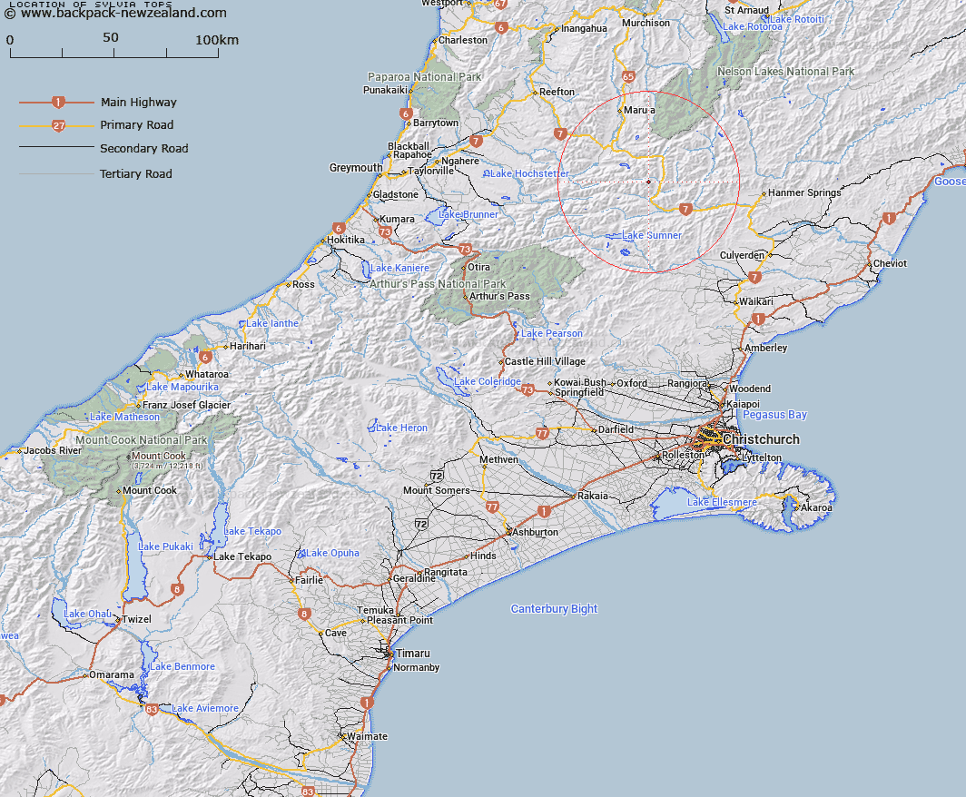
Map showing location of Sylvia Tops


LINZ description: Mountain features at head of Sylvia Stream, lying along the southern watershed of the Nina River.
Latitude: -42.478949
Longitude: 172.341581
Northing: 5296834.4
Easting: 1545882
Land District: Canterbury
Feat Type: Range


Scroll down to see a more detailed road map and below that a topographical map showing the location of Sylvia Tops. The road map has been supplied by openstreetmap and the topographical map of Sylvia Tops has been supplied by Land Information New Zealand (LINZ).

Yes you can use the top static map for you school/university project or personal website with a link back. Contact me for any commercial use.

Sylvia Tops Map New Zealand


New Zealand places in our database
[ A ] [ B ] [ C ] [ D ] [ E ] [ F ] [ G ] [ H ] [ I ] [ J ] [ K ] [ L ] [ M ] [ N ] [ O ] [ P ] [ Q ] [ R ] [ S ] [ T ] [ U ] [ V ] [ W ] [ X ] [ Y ] [ Z ]


Closest 20 Ranges to Sylvia Tops

Libretto Range ( 9.12km )   Poplars Range ( 10.97km )   Doubtful Range ( 11.82km )   Opera Range ( 15.72km )   Freyberg Range ( 15.96km )   Spenser Range ( 21.41km )   Glynn Wye Range ( 22.29km )   The Nelson Tops ( 24.35km )   Organ Range ( 26.28km )   The Brothers ( 28.76km )   Tekoa Range ( 30.92km )   The Sisters ( 31.99km )   The Little Island Hills ( 32.09km )   The Big Island Hills ( 34.3km )   St James Range ( 34.34km )   Crawford Range ( 35.24km )   The Braes ( 35.34km )   Oronoko Range ( 36.39km )   Culverden Range ( 36.67km )   The Hooligan ( 36.68km )   Studleigh Range ( 39.15km )   Hanmer Range ( 42.36km )   The Dreadnought ( 44.69km )   Dampier Range ( 45.24km )   Cavendish Hills ( 47.04km )   Ella Range ( 47.96km )   Crimea Range ( 48.25km )   The Candlesticks ( 49.94km )   Puketeraki Range ( 55.48km )   Snow Cup Range ( 55.76km )   Boddington Range ( 55.78km )   Victoria Range ( 56km )   St Arnaud Range ( 56.5km )   Mahanga Range ( 56.83km )   Poulter Range ( 56.84km )   Doctors Hills ( 61.76km )   Pancake Range ( 62.31km )   Kaimata Range ( 63.58km )   Lowry Peaks Range ( 64.74km )   Old Man Hills ( 65.16km )