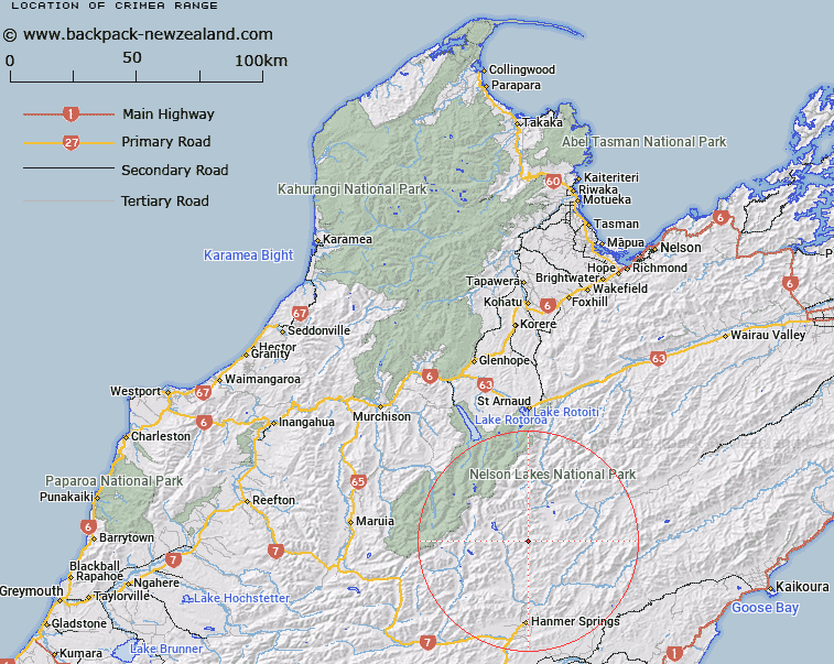
Map showing location of Crimea Range
LINZ description: Mountain range extending from Belvedere Peak [Trig. Z (Geodetic Code A6HA)] in the Spenser Mountains, through Mounts Dora, Guinevere [Trig. K (Geodetic Code A6HB)], and Crystal Peak, Island Pass, and Mount Northumberland [Trig. W (Geodetic Code A7YU)] to Mount Muntz [Trig. V (Geodetic Code B25C)]. Part of range in Canterbury Land District. Block IV Humboldt, Block IV Maling, Blocks IX, XIII and XIV Rainbow, Blocks I, II, V, VI, IX, X, XIII, and XIV Alma, and Blocks I and II Percival Survey Districts.
Latitude: -42.249953
Longitude: 172.840447
Northing: 5322458.9
Easting: 1586838.1
Land District: Nelson, Canterbury
Feat Type: Range
Latitude: -42.249953
Longitude: 172.840447
Northing: 5322458.9
Easting: 1586838.1
Land District: Nelson, Canterbury
Feat Type: Range

Scroll down to see a more detailed road map and below that a topographical map showing the location of Crimea Range. The road map has been supplied by openstreetmap and the topographical map of Crimea Range has been supplied by Land Information New Zealand (LINZ).
Yes you can use the top static map for you school/university project or personal website with a link back. Contact me for any commercial use.
[ A ] [ B ] [ C ] [ D ] [ E ] [ F ] [ G ] [ H ] [ I ] [ J ] [ K ] [ L ] [ M ] [ N ] [ O ] [ P ] [ Q ] [ R ] [ S ] [ T ] [ U ] [ V ] [ W ] [ X ] [ Y ] [ Z ]