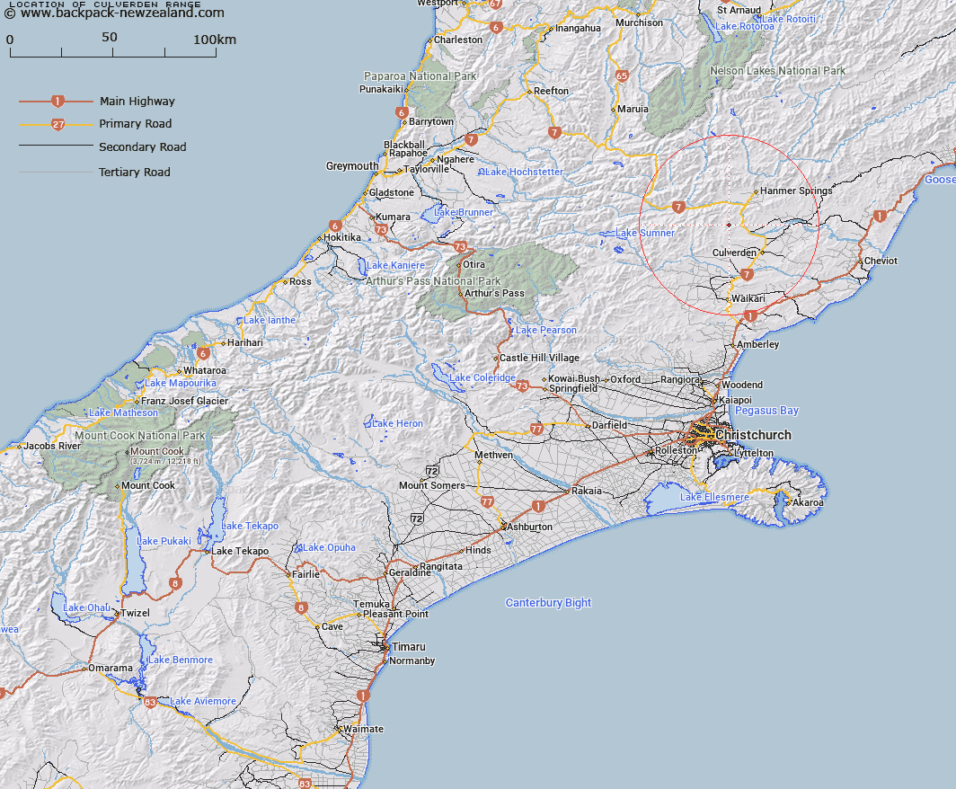
Map showing location of Culverden Range
LINZ description: Mountain range commencing at Mount Culverden [Trig. MC (Geodetic Code A8D4)] and extending generally westerly and northerly through Ben More Hill [Trig. Y (Geodetic Code A8D6)], Mount Cropp [Trig. I (Geodetic Code B27Y)], and Mount Saul [Trig. C (Geodetic Code A8CL)] to Pahau Pass. Blocks XI, XII, and XVI Tekoa, Block IV Mandamus, and Block I Culverden Survey Districts.
Latitude: -42.662553
Longitude: 172.713596
Northing: 5276617.2
Easting: 1576528.3
Land District: Canterbury
Feat Type: Range
Latitude: -42.662553
Longitude: 172.713596
Northing: 5276617.2
Easting: 1576528.3
Land District: Canterbury
Feat Type: Range

Scroll down to see a more detailed road map and below that a topographical map showing the location of Culverden Range. The road map has been supplied by openstreetmap and the topographical map of Culverden Range has been supplied by Land Information New Zealand (LINZ).
Yes you can use the top static map for you school/university project or personal website with a link back. Contact me for any commercial use.
[ A ] [ B ] [ C ] [ D ] [ E ] [ F ] [ G ] [ H ] [ I ] [ J ] [ K ] [ L ] [ M ] [ N ] [ O ] [ P ] [ Q ] [ R ] [ S ] [ T ] [ U ] [ V ] [ W ] [ X ] [ Y ] [ Z ]