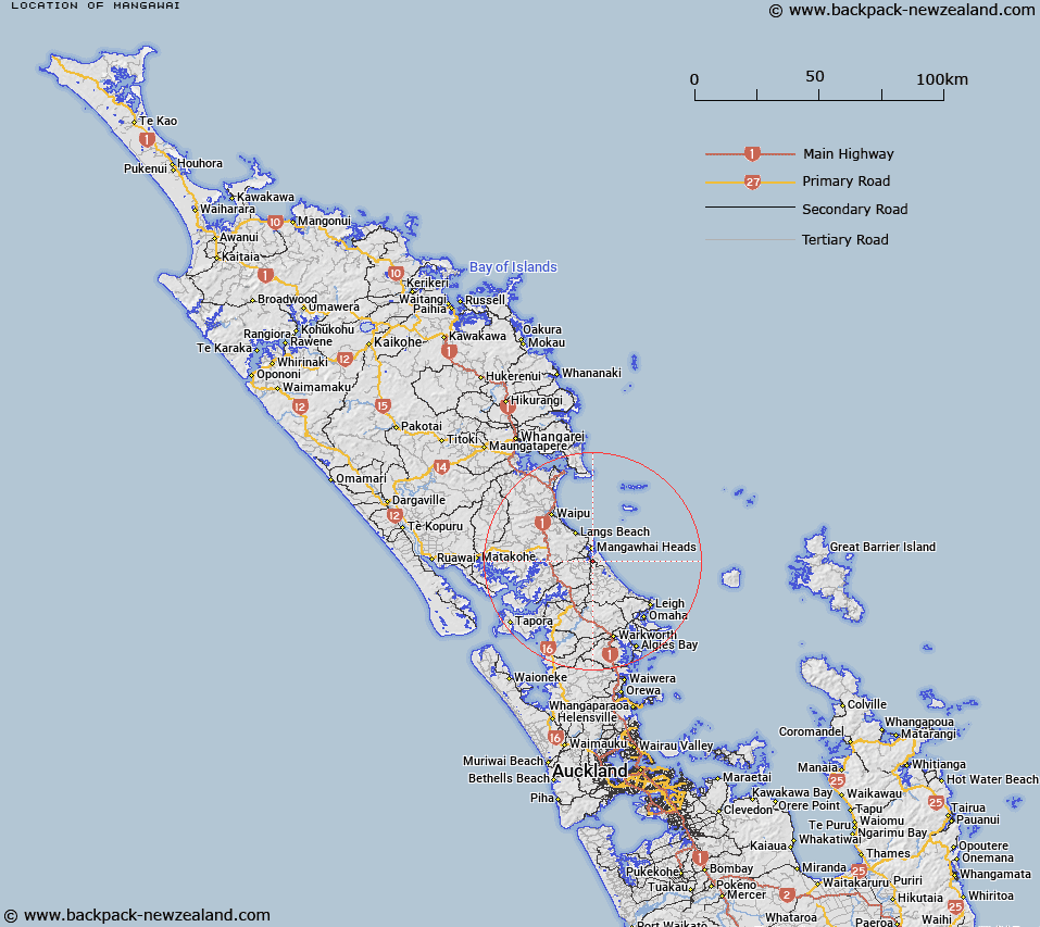
Map showing location of Mangawai


LINZ description: Trig Station 33 (Geodetic Code A9J5), at the summit of Coal Hill Road. (79m) Mangawhai Survey District.
Latitude: -36.142028
Longitude: 174.591275
Northing: 5999125.7
Easting: 1743165.9
Land District: North Auckland
Feat Type: Trig Station


Scroll down to see a more detailed road map and below that a topographical map showing the location of Mangawai. The road map has been supplied by openstreetmap and the topographical map of Mangawai has been supplied by Land Information New Zealand (LINZ).

Yes you can use the top static map for you school/university project or personal website with a link back. Contact me for any commercial use.

Mangawai Map New Zealand


New Zealand places in our database
[ A ] [ B ] [ C ] [ D ] [ E ] [ F ] [ G ] [ H ] [ I ] [ J ] [ K ] [ L ] [ M ] [ N ] [ O ] [ P ] [ Q ] [ R ] [ S ] [ T ] [ U ] [ V ] [ W ] [ X ] [ Y ] [ Z ]


Closest 20 Trig Stations to Mangawai

Mangawai ( 0km )   Mangawhai ( 0km )   Kumete Bluff ( 33.95km )   Te Rokotai ( 49.43km )   Te Whiro ( 54.74km )   Ruaroa ( 58.28km )   Maungatawhiri ( 61.59km )   Paehoka ( 63.6km )   Turiwiri ( 65.55km )   Hikurangi ( 66.52km )   Hohanga ( 70.39km )   Mahora ( 76.54km )   Kaiwaikawe ( 81.13km )   Stony Batter Trig Station ( 86.5km )   Stony Batten Trig Station ( 86.5km )   Patakorokoro ( 91.38km )   Otamaua ( 91.95km )   Kawakawa ( 97.11km )   Ninepins ( 101.31km )   Ninepin ( 101.31km )   Nine Pins ( 101.31km )   Tikitikioure ( 103.11km )   Tikitikiora ( 103.11km )   Whakamakariri ( 104.54km )   Tataweka ( 107.74km )   Whakatere ( 110.9km )   Raeroa ( 110.9km )   Te Ahuahu ( 111.97km )   Tawhitirahi ( 114.02km )   Pukewharareke ( 115.65km )   Mataka ( 117.25km )   Mangawhero ( 120.61km )   Takapuwahia ( 132.88km )   Te Rotomanoao ( 134.38km )   Te Pare ( 134.55km )   Pukeotahinga ( 135.01km )   Teheoriri ( 140.56km )   Tehe o Riri ( 140.56km )   Ratorutoru ( 141.44km )   Ririwha ( 150.12km )