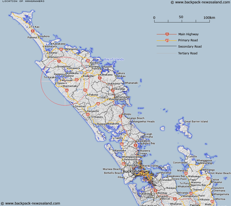
Map showing location of Mangawhero


LINZ description: No information available to be provided at a later date
Latitude: -35.478141
Longitude: 173.533521
Northing: 6073800
Easting: 1648400
Land District: North Auckland
Feat Type: Trig Station


Scroll down to see a more detailed road map and below that a topographical map showing the location of Mangawhero. The road map has been supplied by openstreetmap and the topographical map of Mangawhero has been supplied by Land Information New Zealand (LINZ).

Yes you can use the top static map for you school/university project or personal website with a link back. Contact me for any commercial use.

Mangawhero Map New Zealand


New Zealand places in our database
[ A ] [ B ] [ C ] [ D ] [ E ] [ F ] [ G ] [ H ] [ I ] [ J ] [ K ] [ L ] [ M ] [ N ] [ O ] [ P ] [ Q ] [ R ] [ S ] [ T ] [ U ] [ V ] [ W ] [ X ] [ Y ] [ Z ]


Closest 20 Trig Stations to Mangawhero

Raeroa ( 9.75km )   Whakatere ( 9.75km )   Whakamakariri ( 17.51km )   Te Ahuahu ( 31.78km )   Te Rotomanoao ( 34.33km )   Takapuwahia ( 36.35km )   Patakorokoro ( 39.67km )   Ratorutoru ( 40.65km )   Kawakawa ( 49.23km )   Kaiwaikawe ( 51.8km )   Kaingaroa ( 53.47km )   Pukewhau ( 55.42km )   Mangaroa ( 55.54km )   Maungaroa ( 55.54km )   Tehe o Riri ( 56.35km )   Teheoriri ( 56.35km )   Karangi ( 57.01km )   Takitumu ( 57.01km )   Mahora ( 57.86km )   Hohanga ( 58.16km )   Te Umukukupa ( 60.12km )   Tikitikioure ( 60.48km )   Tikitikiora ( 60.48km )   Ririwha ( 61.63km )   Turiwiri ( 61.82km )   Otamaua ( 62.13km )   Ruaroa ( 62.57km )   Mataka ( 63.4km )   Maungatawhiri ( 64.45km )   Hikurangi ( 69.46km )   Te Whiro ( 71.16km )   Paraawanui ( 72.56km )   Koware No. 2 ( 72.56km )   Houhora ( 80.68km )   Pukeangihau ( 82.5km )   Pukehangihau ( 82.5km )   Kumete Bluff ( 107.97km )   Mangawhai ( 120.61km )   Mangawai ( 120.61km )   Te Rokotai ( 129.25km )