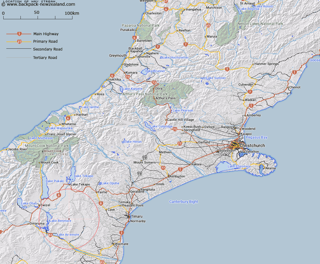
Map showing location of Hay Stream


LINZ description: Stream rising West of Trig. S (Geodetic Code B6YG), and flowing northwards to join Stony Creek 1.3km above Basin Stream. Dalzell Survey District.
Latitude: -44.425577
Longitude: 170.480743
Northing: 5077770.5
Easting: 1399468.8
Land District: Canterbury
Feat Type: Stream


Scroll down to see a more detailed road map and below that a topographical map showing the location of Hay Stream. The road map has been supplied by openstreetmap and the topographical map of Hay Stream has been supplied by Land Information New Zealand (LINZ).

Yes you can use the top static map for you school/university project or personal website with a link back. Contact me for any commercial use.

Hay Stream Map New Zealand


New Zealand places in our database
[ A ] [ B ] [ C ] [ D ] [ E ] [ F ] [ G ] [ H ] [ I ] [ J ] [ K ] [ L ] [ M ] [ N ] [ O ] [ P ] [ Q ] [ R ] [ S ] [ T ] [ U ] [ V ] [ W ] [ X ] [ Y ] [ Z ]


Closest 20 Streams to Hay Stream

Hay Stream ( 0km )   Pringle Stream ( 2.84km )   Basin Stream ( 3.96km )   Preston Stream ( 6.1km )   Balloon Stream ( 6.79km )   Morton Stream ( 8.26km )   Moffat Stream ( 9.13km )   Grampian Stream ( 9.17km )   Innes Burn ( 9.39km )   Ross Stream ( 11.13km )   Dunstan Stream ( 11.29km )   MacGregor Stream ( 13.99km )   Dalgety Stream ( 14.04km )   Gorman Stream ( 14.11km )   Staircase Stream ( 14.29km )   Douglas Stream ( 15.23km )   Longden Stream ( 15.26km )   Black Forest Stream ( 15.33km )   Cattle Creek ( 15.56km )   Scour Stream ( 15.93km )   Deep Stream ( 16.13km )   Two Legged Stream ( 16.27km )   Two Mile Stream ( 16.47km )   Rocky Point Stream ( 16.53km )   Stony River ( 16.76km )   Nessing Stream ( 17.39km )   Anderson Stream ( 17.66km )   Peter Stream ( 17.82km )   Hawkey Stream ( 18.51km )   Hankey Stream ( 18.51km )   Station Stream ( 18.62km )   Rattray Stream ( 18.67km )   Marsack Stream ( 18.68km )   Massack Stream ( 18.68km )   Stony Stream ( 18.98km )   Sutton Stream ( 19.07km )   Potato Creek ( 19.52km )   Deadman Stream ( 19.74km )   Black Jack Stream ( 19.98km )   Fraser Stream ( 20.12km )