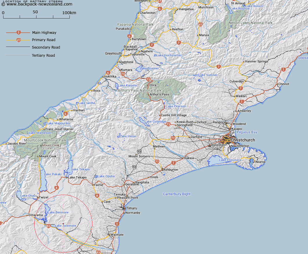
Map showing location of Rattray Stream


LINZ description: Right bank tributary of Deep Stream, rising on the Western slope of Mount Milne [Trig. X (Geodetic Code B70M)], flowing westward and joining Deep Stream 1km East of Trig. H (Geodetic Code AAGJ), upstream of Fraser Stream. Gibson and Hakataramea Survey Districts.
Latitude: -44.590346
Longitude: 170.435555
Northing: 5059356.3
Easting: 1396446.4
Land District: Canterbury
Feat Type: Stream


Scroll down to see a more detailed road map and below that a topographical map showing the location of Rattray Stream. The road map has been supplied by openstreetmap and the topographical map of Rattray Stream has been supplied by Land Information New Zealand (LINZ).

Yes you can use the top static map for you school/university project or personal website with a link back. Contact me for any commercial use.

Rattray Stream Map New Zealand


New Zealand places in our database
[ A ] [ B ] [ C ] [ D ] [ E ] [ F ] [ G ] [ H ] [ I ] [ J ] [ K ] [ L ] [ M ] [ N ] [ O ] [ P ] [ Q ] [ R ] [ S ] [ T ] [ U ] [ V ] [ W ] [ X ] [ Y ] [ Z ]


Closest 20 Streams to Rattray Stream

Fraser Stream ( 1.84km )   Deep Stream ( 2.55km )   Macleod Stream ( 3.07km )   Stony Stream ( 6.05km )   Coal Stream ( 6.89km )   Potato Creek ( 7.4km )   Station Stream ( 9.4km )   Sutton Stream ( 10.02km )   Gibson Stream ( 10.54km )   Douglas Stream ( 10.87km )   Black Jack Stream ( 11.36km )   Baker Creek ( 11.59km )   Padkins Stream ( 11.69km )   Belfield Stream ( 11.99km )   Kirkliston Stream ( 12.44km )   Dry Stream ( 12.47km )   Miller Stream ( 12.79km )   Wharekuri Creek ( 12.9km )   McRae Creek ( 12.96km )   Farm Stream ( 13.1km )   Deadman Stream ( 13.11km )   Banks Stream ( 13.39km )   Boundary Stream ( 13.4km )   Awahokomo Creek ( 13.8km )   Te Akatarewa Stream ( 14.02km )   Fern Gully Creek ( 14.14km )   Poplar Stream ( 15.36km )   Basin Stream ( 15.66km )   Rugged Ridges Creek ( 16.11km )   Whalan Stream ( 16.35km )   Rocky Point Stream ( 16.62km )   Glen Begg Stream ( 16.79km )   Sisters Creek North Branch ( 17.03km )   Sisters Creek South Branch ( 17.28km )   McKays Stream ( 17.34km )   Innes Burn ( 17.62km )   Brothers Stream ( 17.88km )   Awakino River ( 18km )   Little Awakino River ( 18.01km )   Pringle Stream ( 18.47km )