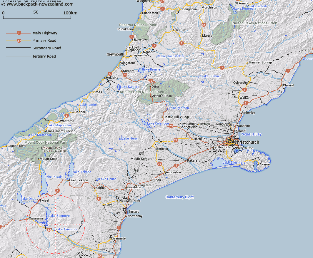
Map showing location of Sutton Stream


LINZ description: Stream rising 1km South-west of Mount Sutton [Trig. I (Geodetic Code AAFM)], flowing southtward into lake Aviemore 1.6km South of Waitangi homestead. Hewlings and Gibson Survey Districts.
Latitude: -44.553281
Longitude: 170.320215
Northing: 5063179.1
Easting: 1387155.9
Land District: Canterbury
Feat Type: Stream


Scroll down to see a more detailed road map and below that a topographical map showing the location of Sutton Stream. The road map has been supplied by openstreetmap and the topographical map of Sutton Stream has been supplied by Land Information New Zealand (LINZ).

Yes you can use the top static map for you school/university project or personal website with a link back. Contact me for any commercial use.

Sutton Stream Map New Zealand


New Zealand places in our database
[ A ] [ B ] [ C ] [ D ] [ E ] [ F ] [ G ] [ H ] [ I ] [ J ] [ K ] [ L ] [ M ] [ N ] [ O ] [ P ] [ Q ] [ R ] [ S ] [ T ] [ U ] [ V ] [ W ] [ X ] [ Y ] [ Z ]


Closest 20 Streams to Sutton Stream

Black Jack Stream ( 1.42km )   Gibson Stream ( 2.03km )   Miller Stream ( 3.68km )   Stony Stream ( 4.08km )   Douglas Stream ( 4.1km )   Te Akatarewa Stream ( 6.86km )   Whalan Stream ( 7.08km )   Glen Begg Stream ( 9.25km )   Fraser Stream ( 9.34km )   Deep Stream ( 9.52km )   Rattray Stream ( 10.02km )   Macleod Stream ( 10.11km )   Dry Stream ( 10.92km )   Banks Stream ( 10.99km )   Coal Stream ( 11.26km )   Boundary Stream ( 11.43km )   Baker Creek ( 11.47km )   McRae Creek ( 12.52km )   Staircase Stream ( 12.73km )   Rugged Ridges Creek ( 12.94km )   Innes Burn ( 13.04km )   Black Forest Stream ( 13.16km )   Coal Creek ( 13.53km )   Fern Gully Creek ( 14.94km )   Basin Stream ( 15.14km )   Parsons Rock Creek ( 15.34km )   Station Creek ( 15.5km )   Wharekuri Creek ( 15.57km )   Peak Valley Creek ( 15.7km )   Shepherds Creek ( 16.54km )   Potato Creek ( 17.22km )   Ross Stream ( 17.91km )   Awahokomo Creek ( 17.94km )   Preston Stream ( 17.99km )   Otamatapaio River ( 18.33km )   Hemphill Creek ( 18.77km )   Clark Creek ( 18.84km )   Station Stream ( 18.85km )   Hay Stream ( 19.07km )   Totara Creek ( 20.29km )