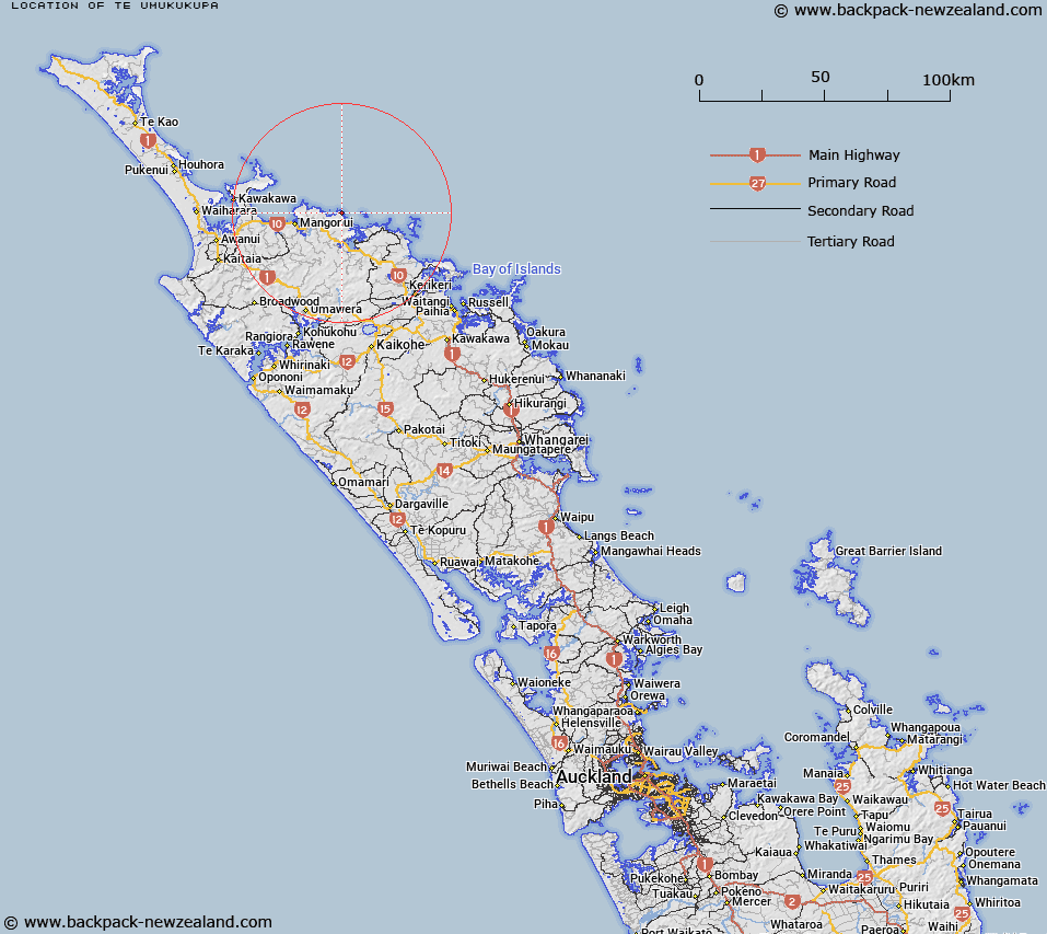
Map showing location of Te Umukukupa


LINZ description: On a height of 209m, approximately 600m east of Karaui Point.
Latitude: -34.954324
Longitude: 173.697676
Northing: 6131800
Easting: 1663700
Land District: North Auckland
Feat Type: Trig Station


Scroll down to see a more detailed road map and below that a topographical map showing the location of Te Umukukupa. The road map has been supplied by openstreetmap and the topographical map of Te Umukukupa has been supplied by Land Information New Zealand (LINZ).

Yes you can use the top static map for you school/university project or personal website with a link back. Contact me for any commercial use.

Te Umukukupa Map New Zealand


New Zealand places in our database
[ A ] [ B ] [ C ] [ D ] [ E ] [ F ] [ G ] [ H ] [ I ] [ J ] [ K ] [ L ] [ M ] [ N ] [ O ] [ P ] [ Q ] [ R ] [ S ] [ T ] [ U ] [ V ] [ W ] [ X ] [ Y ] [ Z ]


Closest 20 Trig Stations to Te Umukukupa

Takitumu ( 3.15km )   Karangi ( 3.15km )   Ririwha ( 7.85km )   Maungaroa ( 11.15km )   Mangaroa ( 11.15km )   Tehe o Riri ( 15.68km )   Teheoriri ( 15.68km )   Ratorutoru ( 19.49km )   Takapuwahia ( 25.66km )   Te Rotomanoao ( 26.44km )   Koware No. 2 ( 27.6km )   Paraawanui ( 27.6km )   Pukewhau ( 34.88km )   Kaingaroa ( 35.09km )   Mataka ( 44.37km )   Te Ahuahu ( 44.84km )   Houhora ( 51.34km )   Pukehangihau ( 54.89km )   Pukeangihau ( 54.89km )   Tikitikioure ( 55.6km )   Tikitikiora ( 55.6km )   Kawakawa ( 57.93km )   Mangawhero ( 60.12km )   Whakamakariri ( 63.18km )   Whakatere ( 63.97km )   Raeroa ( 63.97km )   Patakorokoro ( 64.74km )   Otamaua ( 65.93km )   Hikurangi ( 89.27km )   Ruaroa ( 104.67km )   Kaiwaikawe ( 106.83km )   Hohanga ( 109.67km )   Turiwiri ( 111.82km )   Mahora ( 112.23km )   Maungatawhiri ( 112.98km )   Te Whiro ( 118.2km )   Kumete Bluff ( 153.4km )   Mangawai ( 154.84km )   Mangawhai ( 154.84km )   Te Rokotai ( 177.55km )