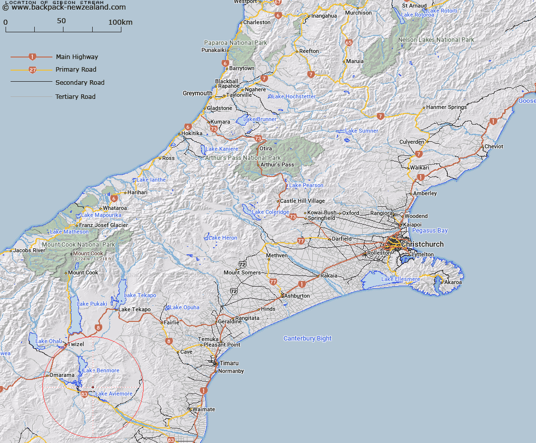
Map showing location of Gibson Stream


LINZ description: Stream rising under Potato Pit Hill and flows south into Sutton Stream approximately 1m from Lake Aviemore near Waitangi Homestead.
Latitude: -44.568464
Longitude: 170.306067
Northing: 5061455.6
Easting: 1386087.9
Land District: Canterbury
Feat Type: Stream


Scroll down to see a more detailed road map and below that a topographical map showing the location of Gibson Stream. The road map has been supplied by openstreetmap and the topographical map of Gibson Stream has been supplied by Land Information New Zealand (LINZ).

Yes you can use the top static map for you school/university project or personal website with a link back. Contact me for any commercial use.

Gibson Stream Map New Zealand


New Zealand places in our database
[ A ] [ B ] [ C ] [ D ] [ E ] [ F ] [ G ] [ H ] [ I ] [ J ] [ K ] [ L ] [ M ] [ N ] [ O ] [ P ] [ Q ] [ R ] [ S ] [ T ] [ U ] [ V ] [ W ] [ X ] [ Y ] [ Z ]


Closest 20 Streams to Gibson Stream

Gibson Stream ( 0km )   Black Jack Stream ( 1.8km )   Sutton Stream ( 2.03km )   Miller Stream ( 2.26km )   Stony Stream ( 4.52km )   Te Akatarewa Stream ( 4.89km )   Whalan Stream ( 5.86km )   Douglas Stream ( 6.11km )   Glen Begg Stream ( 7.41km )   Banks Stream ( 9.12km )   Dry Stream ( 9.14km )   Fraser Stream ( 9.53km )   Boundary Stream ( 9.58km )   Baker Creek ( 9.86km )   Macleod Stream ( 10.02km )   Coal Stream ( 10.47km )   Deep Stream ( 10.5km )   Rattray Stream ( 10.54km )   McRae Creek ( 10.82km )   Rugged Ridges Creek ( 10.96km )   Fern Gully Creek ( 13.3km )   Parsons Rock Creek ( 13.33km )   Station Creek ( 13.48km )   Coal Creek ( 13.83km )   Wharekuri Creek ( 14.17km )   Staircase Stream ( 14.34km )   Black Forest Stream ( 14.67km )   Innes Burn ( 14.98km )   Peak Valley Creek ( 15.4km )   Awahokomo Creek ( 16.7km )   Shepherds Creek ( 16.84km )   Otamatapaio River ( 17.13km )   Basin Stream ( 17.15km )   Clark Creek ( 17.8km )   Potato Creek ( 17.91km )   Hemphill Creek ( 18.22km )   Otematata River ( 19.22km )   Otamatakau River ( 19.22km )   Station Stream ( 19.72km )   Ross Stream ( 19.75km )