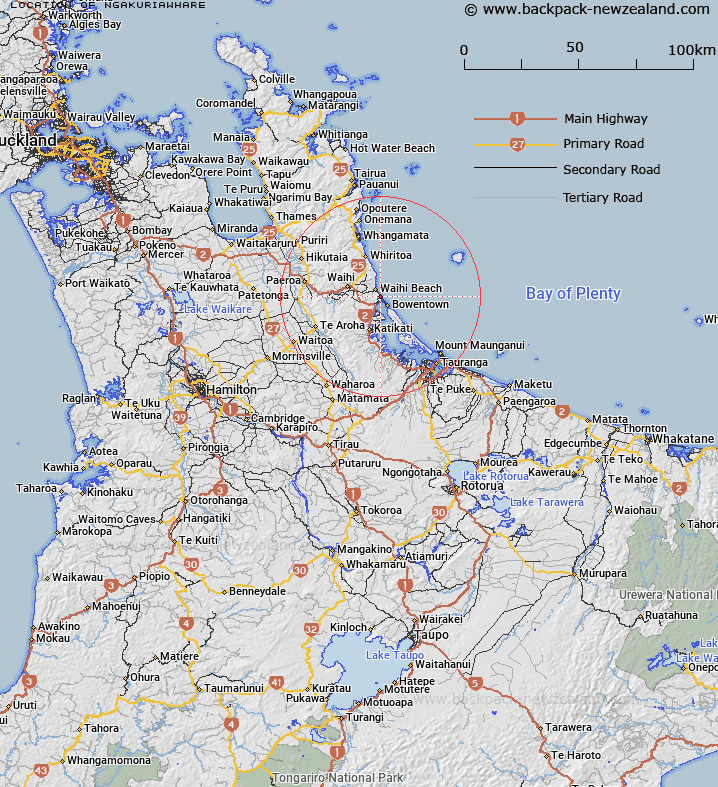
Map showing location of Ngakuriawhare


LINZ description: Located 3.4km south of Waihi Beach at Waiau River
Latitude: -37.431055
Longitude: 175.957676
Northing: 5853200
Easting: 1861700
Land District: South Auckland
Feat Type: Trig Station


Scroll down to see a more detailed road map and below that a topographical map showing the location of Ngakuriawhare. The road map has been supplied by openstreetmap and the topographical map of Ngakuriawhare has been supplied by Land Information New Zealand (LINZ).

Yes you can use the top static map for you school/university project or personal website with a link back. Contact me for any commercial use.

Ngakuriawhare Map New Zealand


New Zealand places in our database
[ A ] [ B ] [ C ] [ D ] [ E ] [ F ] [ G ] [ H ] [ I ] [ J ] [ K ] [ L ] [ M ] [ N ] [ O ] [ P ] [ Q ] [ R ] [ S ] [ T ] [ U ] [ V ] [ W ] [ X ] [ Y ] [ Z ]


Closest 20 Trig Stations to Ngakuriawhare

Tairua ( 44.56km )   Pauanui ( 44.56km )   Te Kauranga ( 50.03km )   Takaurunga ( 50.03km )   New Mangawhero ( 50.14km )   Langmuir ( 50.14km )   Puketuaroa ( 55.04km )   Puketurua ( 55.04km )   Pakotore ( 60.64km )   Pakotare ( 60.64km )   Tiekerero ( 65.51km )   Tiekerereao ( 65.51km )   Te Pare ( 66.44km )   Te Pari ( 70.03km )   Te Pare ( 70.03km )   Te Pareoterawahirua ( 70.03km )   Taupiri ( 70.75km )   Pukewharareke ( 74.37km )   Tawhitirahi ( 76.3km )   Tataweka ( 80.81km )   Pukeotahinga ( 97.71km )   Poutakataka ( 99.92km )   Ngakuru ( 99.92km )   Stony Batter Trig Station ( 101.8km )   Stony Batten Trig Station ( 101.8km )   Tiheroa ( 102.59km )   Tihiroa ( 102.59km )   Pukeahua ( 111.45km )   Ligars ( 112.7km )   Pouraika ( 112.7km )   Taumatamiri ( 114.79km )   Taumatamiere ( 114.79km )   Wharekauanga ( 117.81km )   Wharekaunga ( 117.81km )   Maraonui ( 121.07km )   Maroanui ( 121.07km )   Patawa ( 123.8km )   Pataua ( 123.8km )   Oiraraorao ( 123.85km )   Te Whauotemarama ( 123.95km )