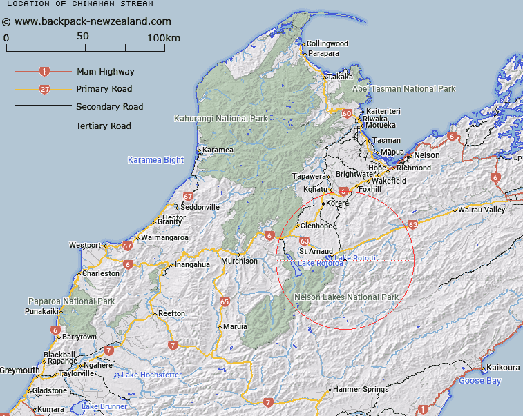
Map showing location of Chinaman Stream


LINZ description: Left bank tributary of Wairau River, rising on the eastern side of the Saint Arnaud Range, East of Parachute Rocks, flowing eastward, and joining Wairau River opposite Sandfly Stream, 5km upstream of Rainbow Homestead. Block II Rotoiti Survey District.
Latitude: -41.830214
Longitude: 172.916132
Northing: 5369071.3
Easting: 1593035.9
Land District: Nelson
Feat Type: Stream


Scroll down to see a more detailed road map and below that a topographical map showing the location of Chinaman Stream. The road map has been supplied by openstreetmap and the topographical map of Chinaman Stream has been supplied by Land Information New Zealand (LINZ).

Yes you can use the top static map for you school/university project or personal website with a link back. Contact me for any commercial use.

Chinaman Stream Map New Zealand


New Zealand places in our database
[ A ] [ B ] [ C ] [ D ] [ E ] [ F ] [ G ] [ H ] [ I ] [ J ] [ K ] [ L ] [ M ] [ N ] [ O ] [ P ] [ Q ] [ R ] [ S ] [ T ] [ U ] [ V ] [ W ] [ X ] [ Y ] [ Z ]


Closest 20 Streams to Chinaman Stream

Merry Stream ( 1.44km )   No Catchem Stream ( 1.69km )   Rough Creek ( 2.55km )   Sandfly Stream ( 3.95km )   Borlase Stream ( 4.3km )   Woolshed Stream ( 4.55km )   St Arnaud Stream ( 4.65km )   Bull Paddock Stream ( 4.7km )   Black Valley Stream ( 5.76km )   Roundell Creek ( 6.31km )   Robert Stream ( 7.98km )   Whisky Creek ( 8.05km )   Duckpond Stream ( 8.22km )   Six Mile Creek ( 8.46km )   5 Mile Creek ( 9.3km )   Pakihi Creek ( 9.63km )   Coldwater Stream ( 9.81km )   Speargrass Creek ( 9.99km )   Te Horowai / Speargrass Creek ( 9.99km )   Clearwater Stream ( 9.99km )   Chandler Stream ( 10.13km )   Tongue Spur Stream ( 10.33km )   Hellfire Stream ( 10.73km )   Dover Stream ( 10.87km )   Lost Stream ( 11.27km )   Six Mile Creek ( 11.7km )   St Ronans Stream ( 11.81km )   Deception Creek ( 11.95km )   Shift Creek ( 12.58km )   Ngaro Stream ( 12.58km )   Misery Stream ( 12.64km )   Rocky Creek ( 12.64km )   Seventeen Creek ( 12.79km )   Teetotal Creek ( 12.82km )   Siberia Stream ( 12.86km )   Bush Camp Stream ( 12.96km )   Diggers Creek ( 13.04km )   Little Siberia Stream ( 13.05km )   Arnst River ( 13.58km )   Arnst Gully ( 13.58km )