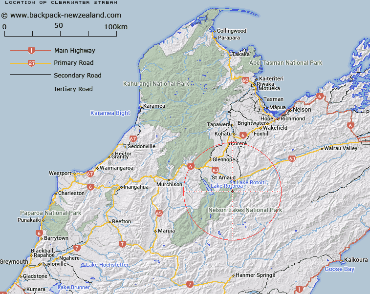
Map showing location of Clearwater Stream


LINZ description: Right bank tributary of Travers River, rising in the Saint Arnaud Range 1.25km South South-west of Mount McRae, flowing eastward then northward, and joining Travers River 1.1km from its mouth at Lake Rotoiti. Block V Rotoiti Survey District.
Latitude: -41.88692
Longitude: 172.822554
Northing: 5362763.6
Easting: 1585278.4
Land District: Nelson
Feat Type: Stream


Scroll down to see a more detailed road map and below that a topographical map showing the location of Clearwater Stream. The road map has been supplied by openstreetmap and the topographical map of Clearwater Stream has been supplied by Land Information New Zealand (LINZ).

Yes you can use the top static map for you school/university project or personal website with a link back. Contact me for any commercial use.

Clearwater Stream Map New Zealand


New Zealand places in our database
[ A ] [ B ] [ C ] [ D ] [ E ] [ F ] [ G ] [ H ] [ I ] [ J ] [ K ] [ L ] [ M ] [ N ] [ O ] [ P ] [ Q ] [ R ] [ S ] [ T ] [ U ] [ V ] [ W ] [ X ] [ Y ] [ Z ]


Closest 20 Streams to Clearwater Stream

Coldwater Stream ( 1.49km )   Chandler Stream ( 2.45km )   Shift Creek ( 2.91km )   Ngaro Stream ( 2.91km )   Hukere Stream ( 4.1km )   Whisky Creek ( 4.84km )   Six Mile Creek ( 4.89km )   Arnst River ( 5.62km )   Arnst Gully ( 5.62km )   Robert Stream ( 6.49km )   Woolshed Stream ( 6.92km )   Speargrass Creek ( 7.25km )   Te Horowai / Speargrass Creek ( 7.25km )   St Ronans Stream ( 7.26km )   Hopeless Creek ( 7.46km )   Rough Creek ( 7.85km )   Hamilton River ( 8.68km )   Borlase Stream ( 8.83km )   Merry Stream ( 8.83km )   Tongue Spur Stream ( 8.99km )   Open Stream ( 9.89km )   Chinaman Stream ( 9.99km )   Cedric Stream ( 10.02km )   Duckpond Stream ( 10.52km )   Hellfire Stream ( 10.62km )   Black Valley Stream ( 10.66km )   St Arnaud Stream ( 11.26km )   Tier Stream ( 11.47km )   No Catchem Stream ( 11.48km )   Cattle Stream ( 11.61km )   Shroders Creek ( 11.77km )   Cupola Creek ( 11.94km )   Hodgson Stream ( 12.01km )   Lees Creek ( 12.37km )   Snows Stream ( 12.69km )   Connors Creek ( 12.71km )   Sandfly Stream ( 13km )   Roundell Creek ( 13.44km )   Summit Creek ( 13.51km )   Swampy Creek ( 13.57km )