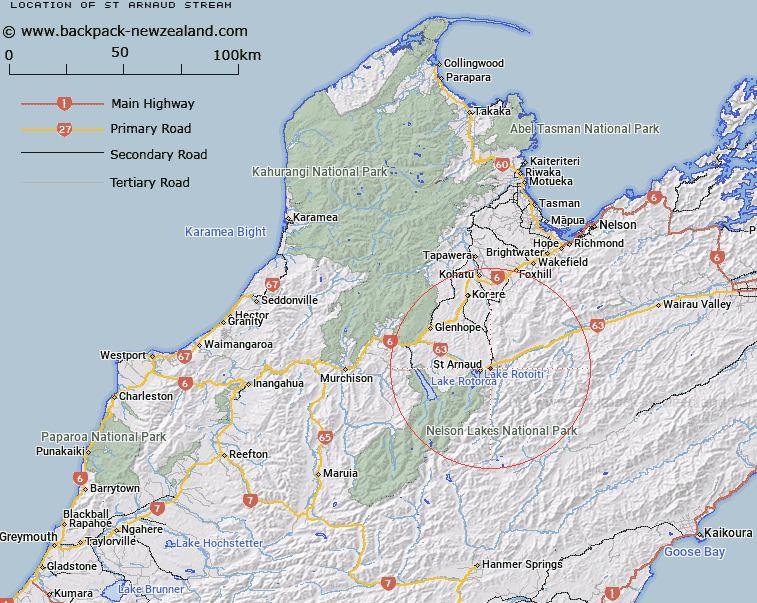
Map showing location of St Arnaud Stream


LINZ description: Left bank tributary of Black Valley Stream, rising 750m North of Trig. E Saint Arnaud (Geodetic Code A5AE), flowing North-westward and flowing into Black Valley Stream 2km North-east of Saint Arnaud township. Blocks XIII and XIV Motupiko Survey District.
Latitude: -41.7963
Longitude: 172.883249
Northing: 5372833.4
Easting: 1590300.2
Land District: Nelson
Feat Type: Stream


Scroll down to see a more detailed road map and below that a topographical map showing the location of St Arnaud Stream. The road map has been supplied by openstreetmap and the topographical map of St Arnaud Stream has been supplied by Land Information New Zealand (LINZ).

Yes you can use the top static map for you school/university project or personal website with a link back. Contact me for any commercial use.

St Arnaud Stream Map New Zealand


New Zealand places in our database
[ A ] [ B ] [ C ] [ D ] [ E ] [ F ] [ G ] [ H ] [ I ] [ J ] [ K ] [ L ] [ M ] [ N ] [ O ] [ P ] [ Q ] [ R ] [ S ] [ T ] [ U ] [ V ] [ W ] [ X ] [ Y ] [ Z ]


Closest 20 Streams to St Arnaud Stream

Black Valley Stream ( 1.62km )   Roundell Creek ( 2.22km )   Borlase Stream ( 2.44km )   No Catchem Stream ( 3.96km )   Duckpond Stream ( 4.37km )   Chinaman Stream ( 4.65km )   Pakihi Creek ( 5.39km )   Merry Stream ( 5.63km )   5 Mile Creek ( 5.91km )   Robert Stream ( 6.36km )   Rough Creek ( 6.38km )   Bull Paddock Stream ( 6.89km )   Whisky Creek ( 7.38km )   Tongue Spur Stream ( 7.46km )   Deception Creek ( 7.56km )   Te Horowai / Speargrass Creek ( 7.91km )   Speargrass Creek ( 7.91km )   Sandfly Stream ( 7.92km )   Seventeen Creek ( 8.14km )   Woolshed Stream ( 8.35km )   Teetotal Creek ( 8.53km )   Diggers Creek ( 8.79km )   Prospector Creek ( 9.11km )   Rocky Creek ( 9.16km )   Two Mile Creek ( 9.86km )   Chandler Stream ( 10.33km )   Coldwater Stream ( 10.47km )   Dover Stream ( 11km )   Six Mile Creek ( 11.07km )   Clearwater Stream ( 11.26km )   Six Mile Creek ( 11.64km )   Beebys Creek ( 12.23km )   Maitland Creek ( 12.61km )   Brough Creek ( 13.02km )   Bush Camp Stream ( 13.14km )   Shift Creek ( 13.14km )   Ngaro Stream ( 13.14km )   Maggie Creek ( 13.37km )   Skeat Creek ( 13.61km )   Homestead Creek ( 13.64km )