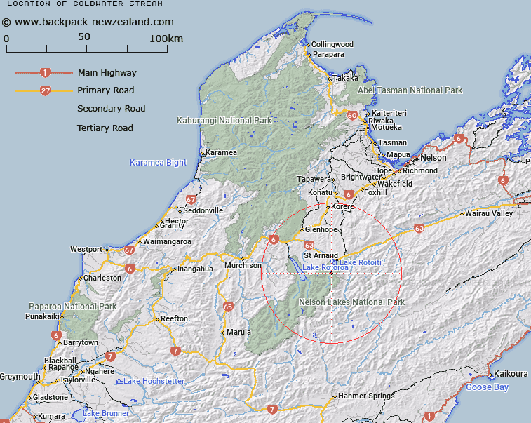
Map showing location of Coldwater Stream


LINZ description: Small stream running along the toe of the hills on the western side of the Travers Valley, joining Chandler Stream near it's mouth at Lake Rotoiti. Block V Rotoiti Survey District.
Latitude: -41.875109
Longitude: 172.814176
Northing: 5364073.4
Easting: 1584580.4
Land District: Nelson
Feat Type: Stream


Scroll down to see a more detailed road map and below that a topographical map showing the location of Coldwater Stream. The road map has been supplied by openstreetmap and the topographical map of Coldwater Stream has been supplied by Land Information New Zealand (LINZ).

Yes you can use the top static map for you school/university project or personal website with a link back. Contact me for any commercial use.

Coldwater Stream Map New Zealand


New Zealand places in our database
[ A ] [ B ] [ C ] [ D ] [ E ] [ F ] [ G ] [ H ] [ I ] [ J ] [ K ] [ L ] [ M ] [ N ] [ O ] [ P ] [ Q ] [ R ] [ S ] [ T ] [ U ] [ V ] [ W ] [ X ] [ Y ] [ Z ]


Closest 20 Streams to Coldwater Stream

Chandler Stream ( 1km )   Clearwater Stream ( 1.49km )   Shift Creek ( 2.79km )   Ngaro Stream ( 2.79km )   Whisky Creek ( 3.56km )   Hukere Stream ( 4.26km )   Robert Stream ( 5.19km )   Te Horowai / Speargrass Creek ( 5.79km )   Speargrass Creek ( 5.79km )   Six Mile Creek ( 6.05km )   Arnst Gully ( 7.06km )   Arnst River ( 7.06km )   Woolshed Stream ( 7.37km )   Tongue Spur Stream ( 7.55km )   Hopeless Creek ( 7.64km )   Rough Creek ( 7.93km )   Borlase Stream ( 8.03km )   St Ronans Stream ( 8.69km )   Merry Stream ( 8.8km )   Cedric Stream ( 9.1km )   Duckpond Stream ( 9.28km )   Open Stream ( 9.59km )   Black Valley Stream ( 9.7km )   Chinaman Stream ( 9.81km )   Hamilton River ( 10.12km )   Tier Stream ( 10.33km )   St Arnaud Stream ( 10.47km )   Hodgson Stream ( 10.73km )   No Catchem Stream ( 11.17km )   Snows Stream ( 11.31km )   Cattle Stream ( 11.43km )   Hellfire Stream ( 11.81km )   Swampy Creek ( 12.31km )   Roundell Creek ( 12.59km )   Teetotal Creek ( 12.67km )   Cupola Creek ( 12.72km )   Sandfly Stream ( 13.13km )   Shroders Creek ( 13.24km )   Maggie Creek ( 13.27km )   Lees Creek ( 13.8km )