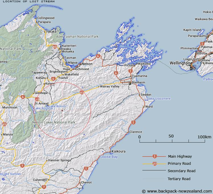
Map showing location of Lost Stream


LINZ description: Left bank tributary of Branch River rising 4.4km West of Scotts Knob (Geodetic Code A445), flowing South-eastward and joining Branch River 5km South of Scotts Knob. Block X, Raglan Survey District.
Latitude: -41.875593
Longitude: 173.037832
Northing: 5364035.7
Easting: 1603139.2
Land District: Marlborough
Feat Type: Stream


Scroll down to see a more detailed road map and below that a topographical map showing the location of Lost Stream. The road map has been supplied by openstreetmap and the topographical map of Lost Stream has been supplied by Land Information New Zealand (LINZ).

Yes you can use the top static map for you school/university project or personal website with a link back. Contact me for any commercial use.

Lost Stream Map New Zealand


New Zealand places in our database
[ A ] [ B ] [ C ] [ D ] [ E ] [ F ] [ G ] [ H ] [ I ] [ J ] [ K ] [ L ] [ M ] [ N ] [ O ] [ P ] [ Q ] [ R ] [ S ] [ T ] [ U ] [ V ] [ W ] [ X ] [ Y ] [ Z ]


Closest 20 Streams to Lost Stream

Siberia Stream ( 2.01km )   Little Siberia Stream ( 2.77km )   Misery Stream ( 4.15km )   Hand Setting Stream ( 4.98km )   Scott Stream ( 5.39km )   Branch River ( 5.49km )   Little Misery Stream ( 5.64km )   Greig Stream ( 7.16km )   Silverstream ( 7.51km )   Sandfly Stream ( 7.64km )   Hut Stream ( 8.42km )   Spaniard Stream ( 8.43km )   Henry Stream ( 8.57km )   Flat Stream ( 9.42km )   Leatham River ( 9.51km )   Bull Paddock Stream ( 9.61km )   Hellfire Stream ( 9.78km )   Hot Rock Stream ( 9.97km )   Merry Stream ( 11.13km )   Cat Stream ( 11.16km )   Woolshed Stream ( 11.19km )   Weka Stream ( 11.22km )   Alan Stream ( 11.23km )   Chinaman Stream ( 11.27km )   Rough Creek ( 11.36km )   No Catchem Stream ( 11.59km )   Barber Stream ( 11.66km )   Gordon Stream ( 11.8km )   Bobs Stream ( 12.57km )   Nesbits Creek ( 13.12km )   Dover Stream ( 13.2km )   Lees Creek ( 13.45km )   Six Mile Creek ( 13.48km )   Waihopai Saddle Stream ( 13.69km )   May Stream ( 14.01km )   Little Cave Stream ( 14.02km )   Bush Camp Stream ( 14.08km )   St Ronans Stream ( 14.29km )   Possum Stream ( 14.38km )   Six Mile Creek ( 15.03km )