New Zealand Backcountry Huts
Huts in New Zealand Beginning with P
These are a mixture of Department of Conservation and private huts. Those without much information are more than likely privately owned and may or maynot be open to the public. If anyone has any information on any of them it would be great if you contacted me and let me know.
The price of a serviced hut is $15 a night, standard hut is $5 a night, Basic/Bivvy are free or you can get an annual pass for $122. All these prices are half price for 11-17 year olds or free if 10 years old and under. The Great Walk huts vary from place to place and season to season but to give you an idea it is $140 a night on the Milford (half price for New Zealanders) to $15 off season and for summer at least they need to be booked through DoC which you can do online @ DoC. I do plan to add the tracks that these huts are on but it is proving to be complicated.
On each individual hut page I have included a zoomable topo map as well as a road map. Most of the information on these hut has been sourced from LINZ and DoC, so thanks to those two government departments :).
| Name | Latitude | Longitude | Area | Type | Photo | |
|---|---|---|---|---|---|---|
| Packhorse Hut | -43.7020507185 | 172.692432341 | Banks Peninsula area | Serviced | 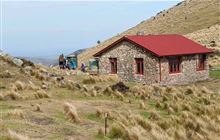 | Map |
| Pahautea Hut | -37.9934843243 | 175.091945804 | Pirongia Forest Park | Standard | 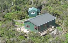 | Map |
| Pakihi Heads Hut | -38.2273937313 | 177.49288264 | Map | |||
| Pakihi Hut | -38.1701716805 | 177.467583371 | Opotiki area, Urutawa Conservation Area | Standard | 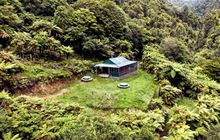 | Map |
| Pakituhi Hut | -44.5820322818 | 169.356406147 | Hāwea Conservation Park | Standard |  | Map |
| Palmer Bivouac | -42.3366492768 | 173.256586011 | Map | |||
| Palmer Hut | -42.2904298392 | 173.260548219 | Ka Whata Tu o Rakihouia Clarence | Standard |  | Map |
| Panekire Hut | -38.8125057376 | 177.051754279 | Te Urewera | Great Walk |  | Map |
| Papatahi Hut | -41.3238365939 | 175.019810274 | Catchpool Valley & Orongorongo Valley, Remutaka Forest Park | Serviced |  | Map |
| Pararaki Hut | -41.5027347074 | 175.303681217 | Aorangi Forest Park | Standard |  | Map |
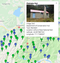
| Park Morpeth Hut | -42.9718024603 | 171.341905262 | Arthur's Pass National Park | Serviced Alpine |  | Map |
| Parks Peak Hut | -39.6775473473 | 176.250557867 | Ruahine Forest Park | Standard |  | Map |
| Paske Hut | -42.1115701515 | 172.754409016 | Upper Wairau River area | Standard |  | Map |
| Paua Hut | -41.3488349964 | 174.965332053 | Map | |||
| Pawnbroker Rock | -44.5898752697 | 167.98583912 | Map | |||
| Peach Cove Hut | -35.8570234787 | 174.566038704 | Bream Head Scenic Reserve, Whangarei Heads area | Serviced | 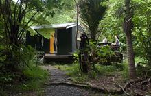 | Map |
| Pearson Hut | -44.6028691201 | 170.429095378 | Kirkliston Range Conservation Area | Basic/bivvies | 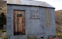 | Map |
| Peats Hut | -44.8298906295 | 168.720532882 | Map | |||
| Pell Stream Hut | -42.3249223497 | 172.337969161 | Lewis Pass Scenic Reserve | Basic/bivvies | 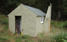 | Map |
| Penk Hut | -41.7869284057 | 173.683736026 | Ferny Gair Conservation Area | Standard | 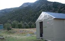 | Map |
| Penn Creek Hut | -40.9015556346 | 175.286381551 | Tararua Forest Park | Standard |  | Map |
| Percy Burn Hut | -46.241393984 | 167.305094277 | Map | |||
| Percy Shelter | -45.5891695904 | 167.323626074 | Map | |||
| Perry Saddle Hut | -40.9011510032 | 172.402904281 | Kahurangi National Park | Great Walk |  | Map |
| Petticoat Junction Hut | -43.1960028229 | 171.91076797 | Map | |||
| Pfeifer Bivouac | -42.8032741134 | 171.665316402 | Map | |||
| Phil's Bivvy | -44.7419173353 | 168.038870115 | Map | |||
| Philip J Cox Memorial Hut | -45.7115487559 | 170.497233971 | Silver Peaks Scenic Reserve | Standard |  | Map |
| Piggotts Hut | -37.0708082093 | 175.183693648 | Map | |||
| Pinchgut Hut | -43.1294275276 | 172.337447458 | Mount Thomas Forest Conservation Area | Standard |  | Map |
| Pinnacle Bivouac | -42.9378671844 | 171.17836635 | Map | |||
| Pinnacles Hut | -43.6099404977 | 171.38249021 | Hakatere Conservation Park, Mount Somers area | Serviced |  | Map |
| Pinnacles Hut | -37.0420440778 | 175.712576277 | Coromandel Forest Park, Kauaeranga Valley | Serviced |  | Map |
| Pioneer Hut | -43.5314385968 | 170.183103505 | Westland Tai Poutini National Park | Serviced Alpine |  | Map |
| Piripiri Hut | -40.0391567902 | 176.016914808 | Ruahine Forest Park | Basic/bivvies | 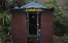 | Map |
| Plateau Hut | -43.5836498402 | 170.184025768 | Aoraki/Mount Cook National Park | Serviced Alpine | 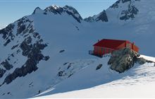 | Map |
| Pleasant Gully Hut | -44.0093434875 | 171.049746795 | Map | |||
| Poet Hut | -43.0359849233 | 171.152375925 | Kokatahi River - Whitcombe River area | Standard | 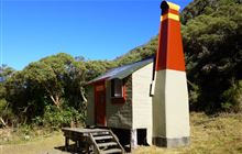 | Map |
| Polluck Creek Hut | -43.0633862224 | 170.82180213 | Mikonui River - Kakapotahi River area | Basic/bivvies | Map | |
| Polnoon Hut | -44.6580606235 | 168.775528509 | Map | |||
| Polson's Hut | -44.6931595013 | 169.605140325 | Map | |||
| Pompolona Lodge | -44.8376037673 | 167.800975252 | Map | |||
| Pool Hut | -42.3958758577 | 172.615582854 | St James Conservation Area | Basic/bivvies | 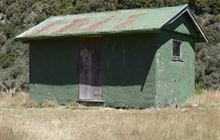 | Map |
| Poor Pete's Hut | -41.6140554273 | 172.322186552 | Kahurangi National Park | Basic/bivvies | 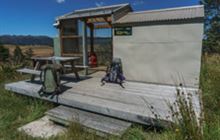 | Map |
| Poplar Hut | -45.751963143 | 170.37856154 | Map | |||
| Poronui Hut | -39.0721670198 | 176.27872021 | Map | |||
| Port Adventure Hunters Hut | -47.0494692976 | 168.176654121 | Rakiura National Park, Stewart Island/Rakiura | Basic/bivvies | 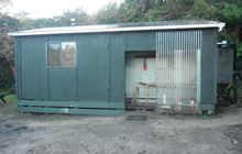 | Map |
| Port Craig Lodge | -46.2218740471 | 167.36170365 | Map | |||
| Port Craig School Hut | -46.2225754911 | 167.361440117 | Fiordland National Park, Tuatapere area | Serviced | 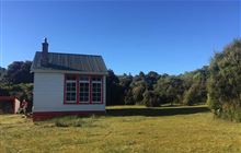 | Map |
| Port William Hut | -46.8357824854 | 168.087142175 | Rakiura National Park, Stewart Island/Rakiura | Great Walk | 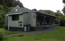 | Map |
[ A ] [ B ] [ C ] [ D ] [ E ] [ F ] [ G ] [ H ] [ I ] [ J ] [ K ] [ L ] [ M ] [ N ] [ O ] [ P ] [ Q ] [ R ] [ S ] [ T ] [ U ] [ V ] [ W ] [ Y ] [ Z ]