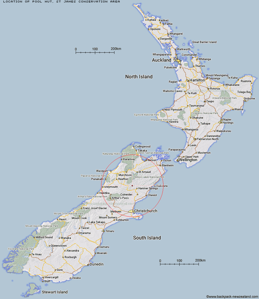
Topo Map showing location of Pool Hut
This information is sourced from DoC, LINZ and Openstreetmap. Some of the hut photos are mine and the rest are from DoC. I will be adding an upload feature soon so people can photos of .Pool Hut.
Basic info: Pool Hut is managed as an historic hut, offering basic accommodation to those doing the 64 km-long St James Cycle Trail.
Latitude: -42.3958758577
Longitude: 172.615582854
Location: St James Conservation Area
Area: Canterbury
Type of Hut: Basic/bivvies
Tracks: St James Cycle Trail
Map: Topo Map | Road Map
Does this hut still exist? Have any more information? Contact
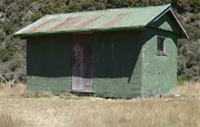
Image: DoC
Scroll down to see a topographical map and road map showing the location of Pool Hut
[ A ] [ B ] [ C ] [ D ] [ E ] [ F ] [ G ] [ H ] [ I ] [ J ] [ K ] [ L ] [ M ] [ N ] [ O ] [ P ] [ Q ] [ R ] [ S ] [ T ] [ U ] [ V ] [ W ] [ Y ] [ Z ]
Closest 20 Huts to Pool Hut
These are as the crow fliesOld Bridge Hut 0.4km Jervois Hut 3.77km Scotties Hut 4.27km Stony Stream Bivouac 7.6km Tin Jug Hut 8.49km Anne Hut 8.68km Anne Cullers Hut 9.31km Steyning Hut 9.43km Stanley Vale Hut 9.6km Lake Guyon Hut 12.4km Christopher Hut 12.65km Rokeby Hut 13.17km Christopher Cullers Hut 13.4km Boyle Flat Hut 14.89km Fowlers Hut 15.32km Magdalen Hut 16.14km Ada Pass Hut 16.5km Cannibal Gorge Hut 17.08km Tutu Hut 17.2km Carlyle Hut 19.79km Bobs Hut 21.9km Lucretia Hut 22.19km East Matakitaki Hut 23km Pell Stream Hut 24.14km Brass Monkey Bivouac 24.73km Nina Hut 25.31km Caroline Creek Bivouac 27.19km Devils Den Bivouac 28.27km Manson-Nicholls Memorial Hut 28.64km Bus Shelter 28.73km Upper Nina Bivouac 29.36km Burn Creek Hut 29.92km Lake Christabel Hut 29.93km Downie Hut 30.14km Doubtful Hut 31.13km Valley Camp Hut 31.64km Upper D'Urville Hut 31.99km Island Gully Hut 32.71km Yarra Hut 33.51km Paske Hut 33.61km