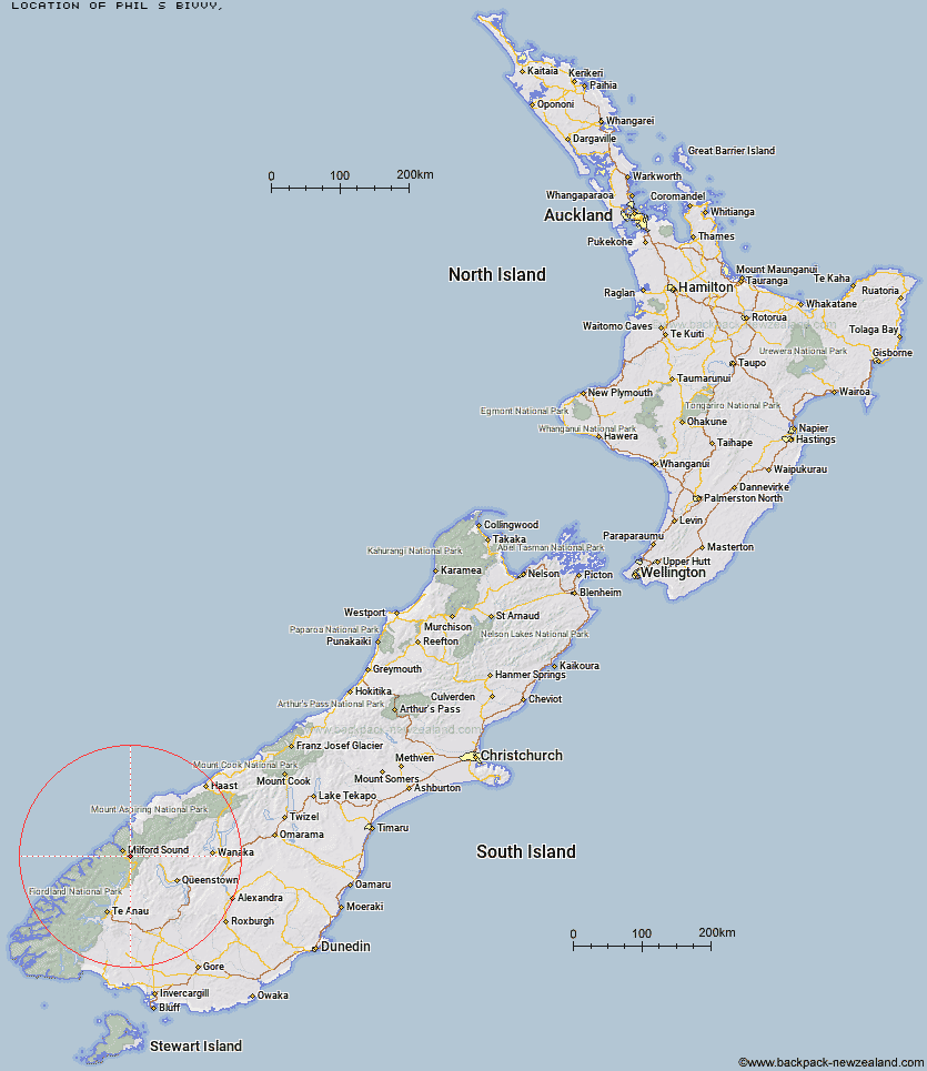
Topo Map showing location of Phil's Bivvy
This information is sourced from DoC, LINZ and Openstreetmap. Some of the hut photos are mine and the rest are from DoC. I will be adding an upload feature soon so people can photos of .Phil's Bivvy.
Latitude: -44.7419173353
Longitude: 168.038870115
Location:
Type of Hut:
Map: Topo Map | Road Map
Does this hut still exist? Have any more information? Contact
Latitude: -44.7419173353
Longitude: 168.038870115
Location:
Type of Hut:
Map: Topo Map | Road Map
Does this hut still exist? Have any more information? Contact
Scroll down to see a topographical map and road map showing the location of Phil's Bivvy
[ A ] [ B ] [ C ] [ D ] [ E ] [ F ] [ G ] [ H ] [ I ] [ J ] [ K ] [ L ] [ M ] [ N ] [ O ] [ P ] [ Q ] [ R ] [ S ] [ T ] [ U ] [ V ] [ W ] [ Y ] [ Z ]
Closest 20 Huts to Phil's Bivvy
These are as the crow fliesGill's Bivvy 0.85km Homer Hut 4.02km Lake Mackenzie Hut 11.02km Lake Mackenzie Lodge 11.04km The Divide Shelter 11.12km Lake Howden Hut 11.18km Sandfly Point Shelter 12.62km Routeburn Falls Lodge 12.76km Routeburn Falls Hut 12.81km Turners Bivouac 13.59km Sunshine Hut 13.99km Routeburn Flats Hut 14.06km Hidden Falls Hut 14.45km Giant Gate Shelter 15.35km McKellar Lodge 16.47km McKellar Hut 16.69km Pawnbroker Rock 17.42km Kay Creek Hut 17.57km Upper Caples Hut 18.38km Boatshed Hut 18.7km Boatshed Shelter 18.75km Routeburn Shelter 19.09km Clinton Hut 20.94km Hirere Shelter 21.13km Prairie Shelter 21.22km Bus Stop Shelter 21.54km Pompolona Lodge 21.58km Mintaro Hut 21.67km Andersons Cascade Shelter 21.71km Glade House 21.76km Dumpling Hut 21.83km Mackinnon Pass Shelter 21.86km Quintin Lodge 23.2km Lake Alabaster Hut 23.33km Steele Creek Hut 24.76km Mid Caples Hut 24.89km McKerrow Island Hut 24.98km Rats Nest Hut 25.4km Home Hill Hut 27.11km Worsley Hut 27.57km