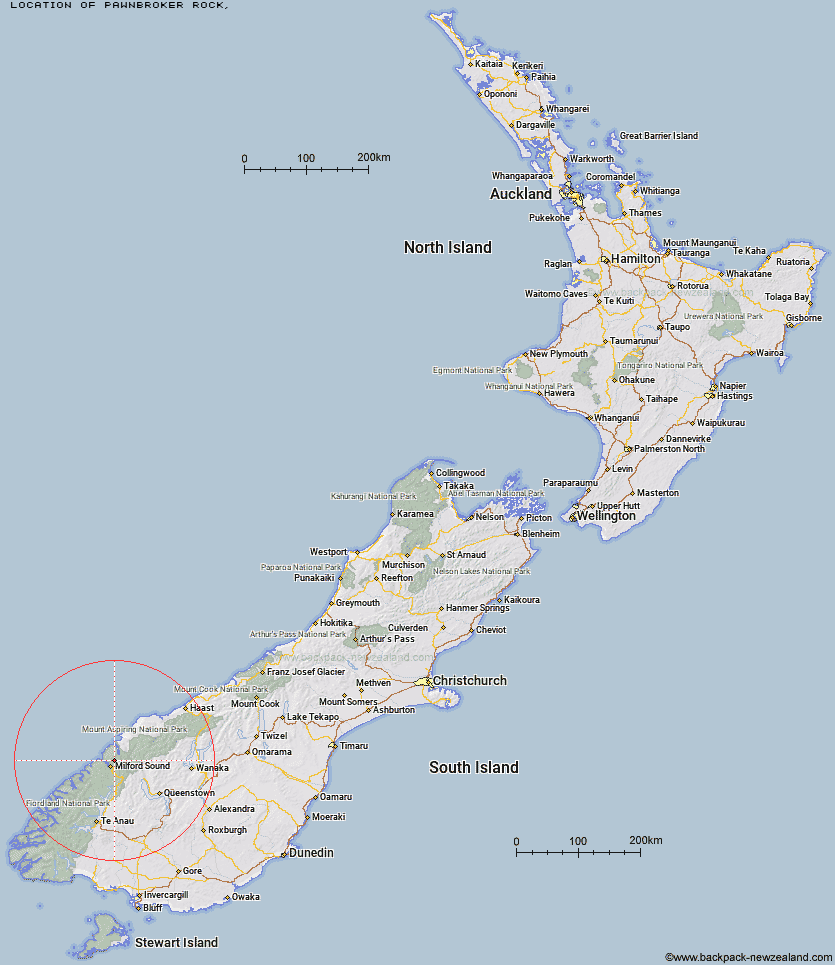
Topo Map showing location of Pawnbroker Rock
This information is sourced from DoC, LINZ and Openstreetmap. Some of the hut photos are mine and the rest are from DoC. I will be adding an upload feature soon so people can photos of .Pawnbroker Rock.
Latitude: -44.5898752697
Longitude: 167.98583912
Location:
Type of Hut:
Map: Topo Map | Road Map
Does this hut still exist? Have any more information? Contact
Latitude: -44.5898752697
Longitude: 167.98583912
Location:
Type of Hut:
Map: Topo Map | Road Map
Does this hut still exist? Have any more information? Contact
Scroll down to see a topographical map and road map showing the location of Pawnbroker Rock
[ A ] [ B ] [ C ] [ D ] [ E ] [ F ] [ G ] [ H ] [ I ] [ J ] [ K ] [ L ] [ M ] [ N ] [ O ] [ P ] [ Q ] [ R ] [ S ] [ T ] [ U ] [ V ] [ W ] [ Y ] [ Z ]
Closest 20 Huts to Pawnbroker Rock
These are as the crow fliesTurners Bivouac 4.38km McKerrow Island Hut 10.09km Hidden Falls Hut 10.85km Sunshine Hut 11.33km Kaipo Hut 11.75km Sandfly Point Shelter 12.44km Demon Trail Hut 12.7km Lake Alabaster Hut 13.46km Gill's Bivvy 16.58km Giant Gate Shelter 16.78km Phil's Bivvy 17.42km Hokuri Hut 19.59km Homer Hut 19.78km Boatshed Hut 21.95km Boatshed Shelter 21.98km Routeburn Falls Lodge 22.67km Routeburn Falls Hut 22.67km Routeburn Flats Hut 23.61km Olivine Hut 24.31km Lake Mackenzie Hut 24.71km Lake Mackenzie Lodge 24.81km Dumpling Hut 26.43km Routeburn Shelter 27.22km Lake Howden Hut 27.74km The Divide Shelter 28.13km Andersons Cascade Shelter 28.21km Martins Bay Hut 28.4km Mackinnon Pass Shelter 28.9km Quintin Lodge 28.98km Mintaro Hut 29.3km Kay Creek Hut 31.07km Daleys Flat Hut 31.13km Pompolona Lodge 31.18km Bus Stop Shelter 31.36km Prairie Shelter 31.52km Hirere Shelter 33.17km Esquilant Bivvy Hut 33.47km McKellar Lodge 33.54km McKellar Hut 33.77km Upper Caples Hut 33.87km