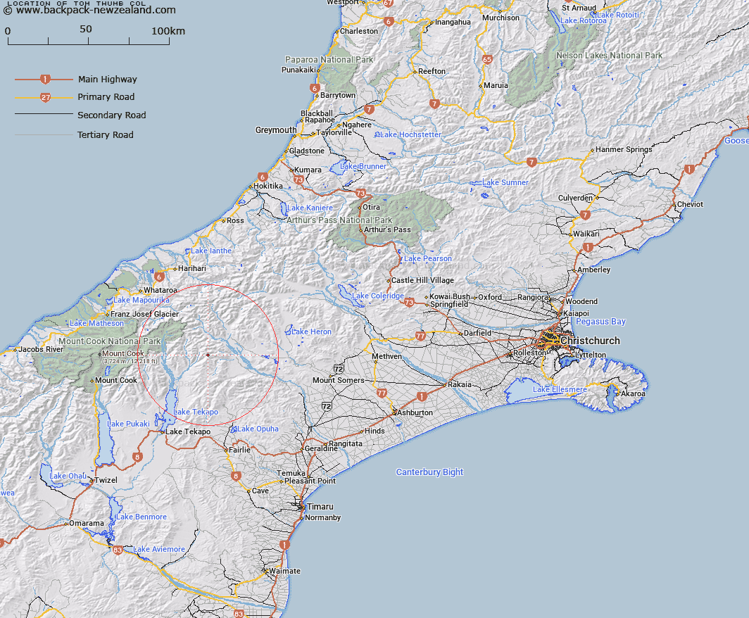
Map showing location of Tom Thumb Col


LINZ description: On the Two Thumb Range
Latitude: -43.597771
Longitude: 170.73152
Northing: 5170300
Easting: 1416900
Land District: Canterbury
Feat Type: Pass


Scroll down to see a more detailed road map and below that a topographical map showing the location of Tom Thumb Col. The road map has been supplied by openstreetmap and the topographical map of Tom Thumb Col has been supplied by Land Information New Zealand (LINZ).

Yes you can use the top static map for you school/university project or personal website with a link back. Contact me for any commercial use.

Tom Thumb Col Map New Zealand


New Zealand places in our database
[ A ] [ B ] [ C ] [ D ] [ E ] [ F ] [ G ] [ H ] [ I ] [ J ] [ K ] [ L ] [ M ] [ N ] [ O ] [ P ] [ Q ] [ R ] [ S ] [ T ] [ U ] [ V ] [ W ] [ X ] [ Y ] [ Z ]


Closest 20 Passs to Tom Thumb Col

Athene Col ( 1.27km )   Brabazon Saddle ( 2.61km )   Cassandra Col ( 2.64km )   Helen Col ( 2.77km )   Alma Col ( 4.22km )   Inkerman Saddle ( 6.11km )   Balaclava Saddle ( 6.95km )   Balaclava Saddle ( 6.95km )   Plata Col ( 7.78km )   Stag Saddle ( 14.11km )   Bullock Bow Saddle ( 14.41km )   Easy Col ( 15.34km )   Twilight Col ( 16.8km )   Separation Col ( 18.28km )   Revelation Col ( 18.57km )   Terra Nova Pass ( 19.96km )   St Winifred Col ( 20.38km )   Hidden Col ( 21.49km )   Dummy Col ( 21.66km )   Dennistoun Pass ( 22.2km )   Butler Saddle ( 22.29km )   Stewart Saddle ( 22.56km )   Fan Col ( 22.89km )   Veil Col ( 23.31km )   Balmacaan Saddle ( 23.72km )   Gunn Pass ( 23.92km )   Sealy Pass ( 24.12km )   Rankin Pass ( 25.14km )   Orb Col ( 25.31km )   Maud Pass ( 25.75km )   Jacqueline Col ( 25.86km )   Armadillo Saddle ( 25.9km )   Godley Pass ( 25.99km )   Grey Pass ( 26.82km )   Disappointment Saddle ( 27.59km )   Classen Saddle ( 28.21km )   Havelock Col ( 28.22km )   Musterers Col ( 28.87km )   Whataroa Saddle ( 28.9km )   Crossbow Saddle ( 28.9km )