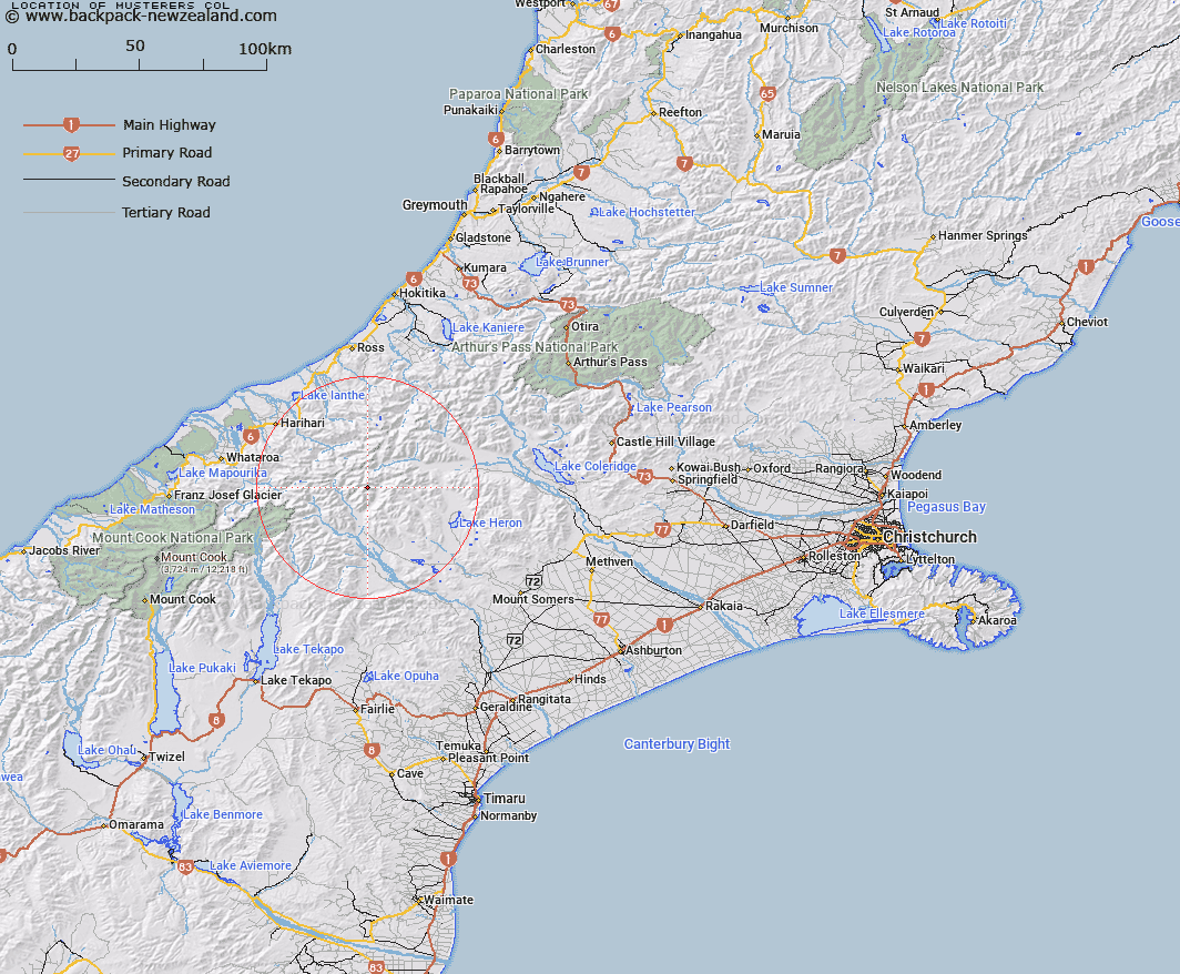
Map showing location of Musterers Col


LINZ description: Between Sinclair Glacier and Outlaw Creek
Latitude: -43.359176
Longitude: 170.872474
Northing: 5197100
Easting: 1427600
Land District: Canterbury
Feat Type: Pass


Scroll down to see a more detailed road map and below that a topographical map showing the location of Musterers Col. The road map has been supplied by openstreetmap and the topographical map of Musterers Col has been supplied by Land Information New Zealand (LINZ).

Yes you can use the top static map for you school/university project or personal website with a link back. Contact me for any commercial use.

Musterers Col Map New Zealand


New Zealand places in our database
[ A ] [ B ] [ C ] [ D ] [ E ] [ F ] [ G ] [ H ] [ I ] [ J ] [ K ] [ L ] [ M ] [ N ] [ O ] [ P ] [ Q ] [ R ] [ S ] [ T ] [ U ] [ V ] [ W ] [ X ] [ Y ] [ Z ]


Closest 20 Passs to Musterers Col

Bandolero Col ( 0.41km )   Crossbow Saddle ( 1.84km )   Battleaxe Col ( 2.59km )   Toledo Col ( 3.15km )   Gladiator Col ( 4.23km )   Ambrose Saddle ( 4.45km )   McCoy Col ( 6.73km )   Chowbok Col ( 7.57km )   Rangitata Col ( 7.86km )   Malcolm Col ( 8.64km )   Cameron Col ( 9.1km )   Lambert Col ( 9.27km )   Gadarene Col ( 9.76km )   Fan Col ( 11.38km )   Lawrence Col ( 11.38km )   Veil Col ( 11.71km )   Jagged Col ( 11.98km )   Strachan Pass ( 12.11km )   Reischek Col ( 12.21km )   Groove Col ( 12.3km )   Perth Col ( 12.95km )   Lucknow Saddle ( 12.95km )   Satan Saddle ( 13.09km )   Peg Col ( 13.13km )   Menace Gap ( 13.67km )   Disappointment Saddle ( 13.68km )   Boulder Col ( 14.03km )   Camp Saddle ( 14.35km )   Orb Col ( 14.38km )   Havelock Col ( 14.84km )   Adams Col ( 15.43km )   Angel Col ( 17km )   Whitcombe Pass ( 17.21km )   Erewhon Col ( 18.06km )   Full Moon Saddle ( 18.49km )   Gunn Pass ( 19.24km )   Red Lion Col ( 19.36km )   Iceland Col ( 19.77km )   Vertebrae Col ( 20.72km )   McKenzie Col ( 20.8km )