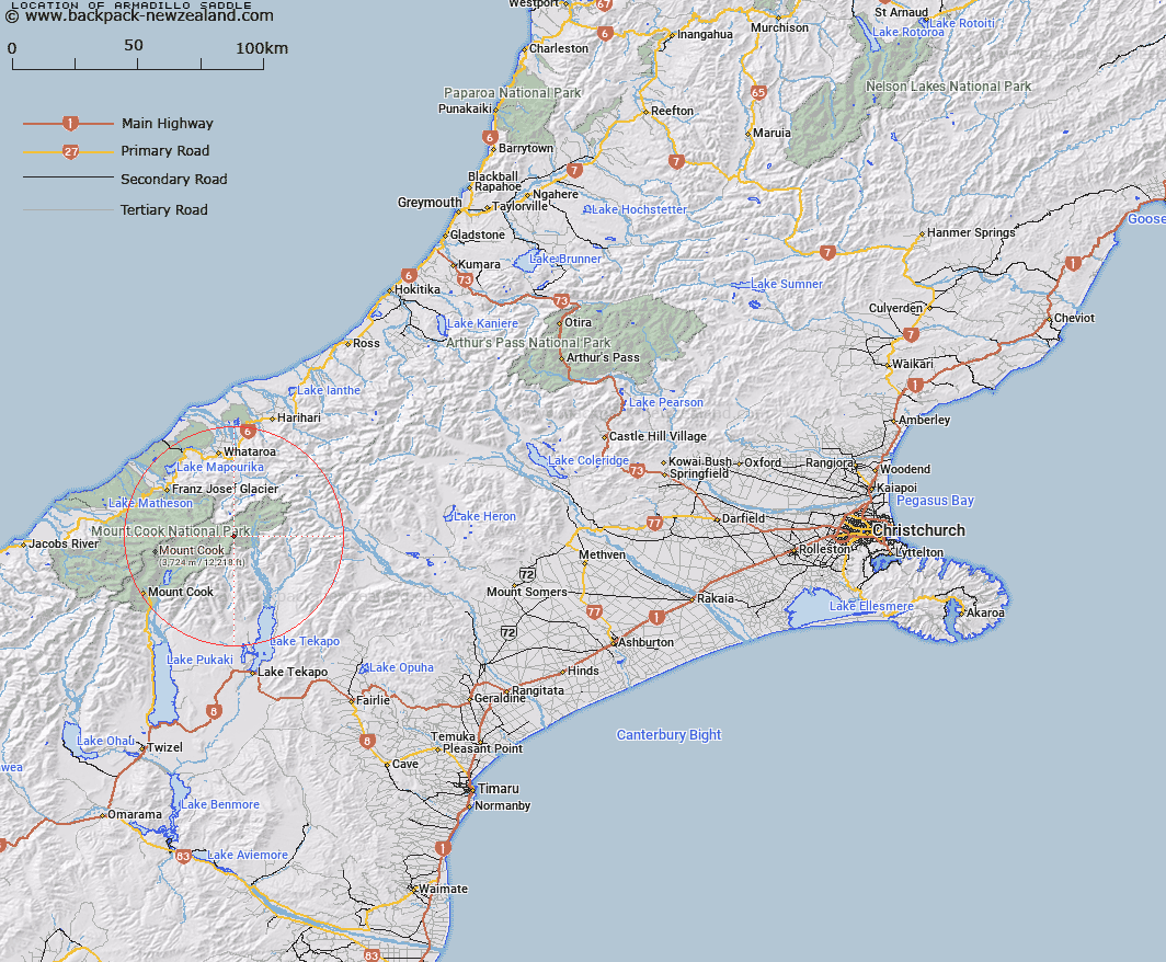
Map showing location of Armadillo Saddle


LINZ description: On Liebig Range between the Anthill and Conrad Peaks, at the head of the Rutherford Stream. Cook Survey District.
Latitude: -43.545116
Longitude: 170.418398
Northing: 5175410.1
Easting: 1391443.9
Land District: Canterbury
Feat Type: Pass


Scroll down to see a more detailed road map and below that a topographical map showing the location of Armadillo Saddle. The road map has been supplied by openstreetmap and the topographical map of Armadillo Saddle has been supplied by Land Information New Zealand (LINZ).

Yes you can use the top static map for you school/university project or personal website with a link back. Contact me for any commercial use.

Armadillo Saddle Map New Zealand


New Zealand places in our database
[ A ] [ B ] [ C ] [ D ] [ E ] [ F ] [ G ] [ H ] [ I ] [ J ] [ K ] [ L ] [ M ] [ N ] [ O ] [ P ] [ Q ] [ R ] [ S ] [ T ] [ U ] [ V ] [ W ] [ X ] [ Y ] [ Z ]


Closest 20 Passs to Armadillo Saddle

Godley Pass ( 2.69km )   Starvation Saddle ( 4.37km )   Classen Saddle ( 4.94km )   Whymper Saddle ( 5.79km )   Tasman Saddle ( 5.88km )   Whataroa Saddle ( 6.08km )   Rankin Pass ( 6.85km )   Lendenfeld Saddle ( 8.78km )   Divers Col ( 10.13km )   Malte Brun Pass ( 10.37km )   Climbers Col ( 10.52km )   Rutherford Pass ( 10.58km )   Kehua Pass ( 11.75km )   Ailsa Pass ( 12.76km )   Graham Saddle ( 13.54km )   Grey Pass ( 14.17km )   Callery Saddle ( 14.37km )   Jollie Saddle ( 14.55km )   Jacqueline Col ( 15.42km )   Maud Pass ( 15.61km )   Separation Col ( 16.05km )   Frenchay Col ( 16.2km )   Twilight Col ( 16.25km )   Revelation Col ( 16.53km )   Abbey Pass ( 16.98km )   Sealy Pass ( 17.43km )   Tatare Saddle ( 17.67km )   West Hoe Pass ( 18.08km )   Governor Col ( 18.34km )   Newton Pass ( 18.46km )   Stewart Saddle ( 18.5km )   Pioneer Pass ( 18.92km )   Halcombe Col ( 19.43km )   Marcel Pass ( 19.68km )   Terra Nova Pass ( 19.77km )   St Winifred Col ( 20.04km )   Plata Col ( 20.1km )   Easy Col ( 20.27km )   Engineer Pass ( 20.35km )   Engineer Col ( 20.38km )