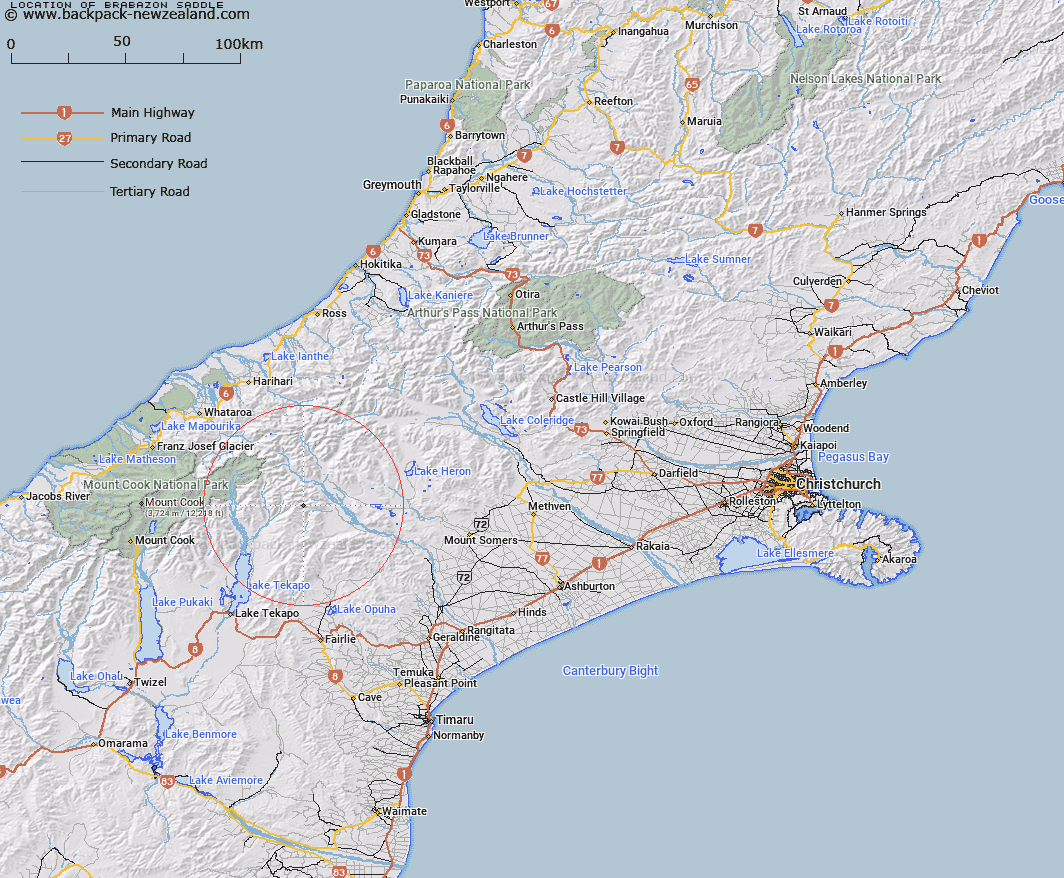
Map showing location of Brabazon Saddle


LINZ description: Saddle in the Brabazon Range 2.1km North-east of Mount Caton, between tributaries of Bush Stream and Black Birch Creek. Block IX Sinclair Survey District.
Latitude: -43.602354
Longitude: 170.76334
Northing: 5169860.7
Easting: 1419482.1
Land District: Canterbury
Feat Type: Pass


Scroll down to see a more detailed road map and below that a topographical map showing the location of Brabazon Saddle. The road map has been supplied by openstreetmap and the topographical map of Brabazon Saddle has been supplied by Land Information New Zealand (LINZ).

Yes you can use the top static map for you school/university project or personal website with a link back. Contact me for any commercial use.

Brabazon Saddle Map New Zealand


New Zealand places in our database
[ A ] [ B ] [ C ] [ D ] [ E ] [ F ] [ G ] [ H ] [ I ] [ J ] [ K ] [ L ] [ M ] [ N ] [ O ] [ P ] [ Q ] [ R ] [ S ] [ T ] [ U ] [ V ] [ W ] [ X ] [ Y ] [ Z ]


Closest 20 Passs to Brabazon Saddle

Tom Thumb Col ( 2.61km )   Athene Col ( 3.75km )   Cassandra Col ( 4.67km )   Helen Col ( 5.1km )   Inkerman Saddle ( 5.1km )   Alma Col ( 5.51km )   Balaclava Saddle ( 9.03km )   Balaclava Saddle ( 9.03km )   Plata Col ( 9.98km )   Bullock Bow Saddle ( 13.25km )   Stag Saddle ( 14.51km )   Easy Col ( 17.03km )   Twilight Col ( 18.89km )   Separation Col ( 20.36km )   Revelation Col ( 20.61km )   Butler Saddle ( 20.9km )   Balmacaan Saddle ( 21.12km )   Terra Nova Pass ( 21.7km )   St Winifred Col ( 22.11km )   Hidden Col ( 23.17km )   Dummy Col ( 23.29km )   Fan Col ( 23.47km )   Dennistoun Pass ( 23.82km )   Veil Col ( 23.94km )   Stewart Saddle ( 24.45km )   Gunn Pass ( 25.31km )   Sealy Pass ( 26.12km )   Orb Col ( 26.23km )   Rankin Pass ( 27.69km )   Maud Pass ( 27.88km )   Jacqueline Col ( 28.01km )   Disappointment Saddle ( 28.42km )   Musterers Col ( 28.44km )   Armadillo Saddle ( 28.51km )   Godley Pass ( 28.59km )   Crossbow Saddle ( 28.64km )   Battleaxe Col ( 28.79km )   Bandolero Col ( 28.85km )   Grey Pass ( 29.05km )   Havelock Col ( 29.14km )