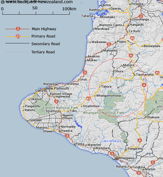
Map showing location of Papaumu
LINZ description: Trig. Station (Geodetic Code AKV5), situated near the junction of the Ohura and Wanganui Rivers in Block XI, Heao Survey District
Latitude: -39.040897
Longitude: 175.043459
Northing: 5676698.1
Easting: 1776852.6
Land District: Taranaki
Feat Type: Trig Station
Latitude: -39.040897
Longitude: 175.043459
Northing: 5676698.1
Easting: 1776852.6
Land District: Taranaki
Feat Type: Trig Station

Scroll down to see a more detailed road map and below that a topographical map showing the location of Papaumu. The road map has been supplied by openstreetmap and the topographical map of Papaumu has been supplied by Land Information New Zealand (LINZ).
Yes you can use the top static map for you school/university project or personal website with a link back. Contact me for any commercial use.
[ A ] [ B ] [ C ] [ D ] [ E ] [ F ] [ G ] [ H ] [ I ] [ J ] [ K ] [ L ] [ M ] [ N ] [ O ] [ P ] [ Q ] [ R ] [ S ] [ T ] [ U ] [ V ] [ W ] [ X ] [ Y ] [ Z ]