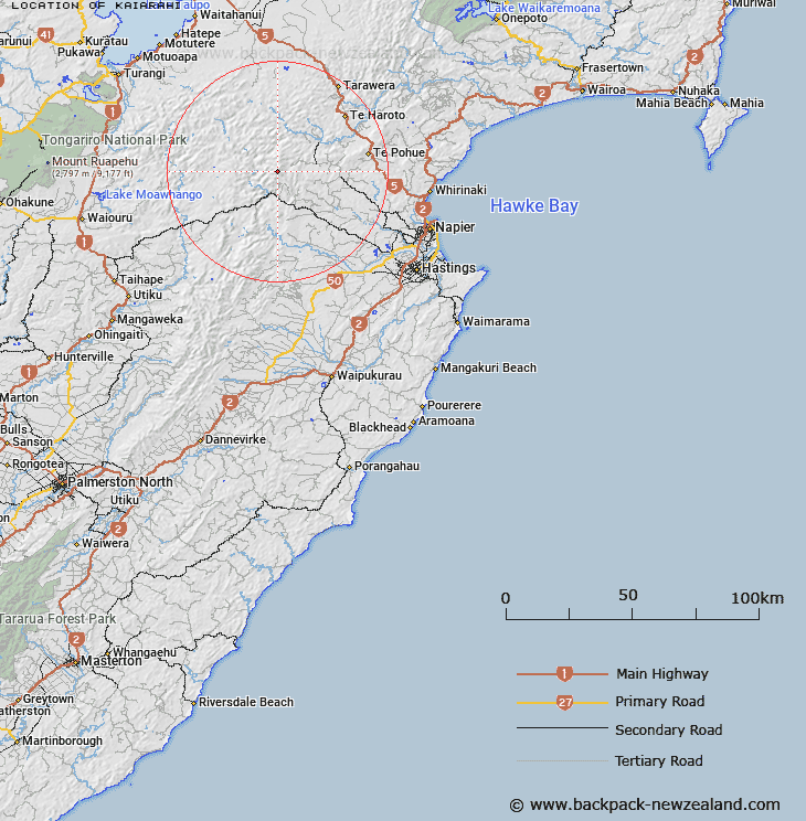
Map showing location of Kaiarahi


LINZ description: In place of Callow Peak or Pakiwhenua
Latitude: -39.312963
Longitude: 176.362374
Northing: 5643100
Easting: 1889900
Land District: Hawke's Bay
Feat Type: Trig Station


Scroll down to see a more detailed road map and below that a topographical map showing the location of Kaiarahi. The road map has been supplied by openstreetmap and the topographical map of Kaiarahi has been supplied by Land Information New Zealand (LINZ).

Yes you can use the top static map for you school/university project or personal website with a link back. Contact me for any commercial use.

Kaiarahi Map New Zealand


New Zealand places in our database
[ A ] [ B ] [ C ] [ D ] [ E ] [ F ] [ G ] [ H ] [ I ] [ J ] [ K ] [ L ] [ M ] [ N ] [ O ] [ P ] [ Q ] [ R ] [ S ] [ T ] [ U ] [ V ] [ W ] [ X ] [ Y ] [ Z ]


Closest 20 Trig Stations to Kaiarahi

Kuripapango ( 5.24km )   Kohinga ( 11.5km )   End ( 12.12km )   Tauwheketewhango ( 23.7km )   Tawheketewhango ( 23.7km )   Tawai-Tohunga ( 23.7km )   Tawake Tohunga ( 23.7km )   Parahakipaku ( 23.81km )   Wakaateo ( 31.94km )   Waka Atea ( 31.94km )   Puketautahi ( 33.48km )   Tataraakin ( 37.34km )   Thunderbolt ( 37.65km )   Pohatuhaha ( 39.34km )   Parks Peak ( 39.34km )   Salisbury ( 42.12km )   Remutupo ( 47.27km )   Waikamaka ( 47.27km )   Patuwahine ( 49.61km )   Te Atuaoparapara ( 57.02km )   Kawhatau ( 60.95km )   Mangaweka ( 60.95km )   Motuoapa ( 61.3km )   Paemutu ( 62.27km )   Ohuinga ( 64.27km )   Pukakaramea ( 67.48km )   Pukaramea ( 67.48km )   Kahuranaki ( 69.16km )   Kauranaki ( 69.16km )   Patuwahine ( 69.78km )   Tuawatawata ( 75.35km )   Tuwatawata ( 75.35km )   Wairakai ( 77.44km )   Mapouriki ( 79.59km )   Maporiki ( 79.59km )   Kiorenui ( 87.48km )   Kioronui ( 87.48km )   Mangamahu ( 90.25km )   Oiraraorao ( 91.74km )   Tutaengarahu ( 92.2km )