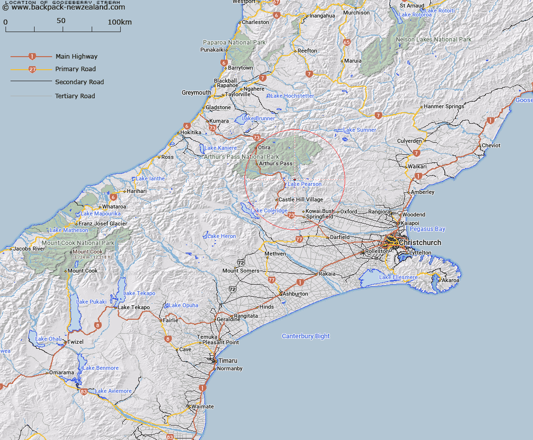
Map showing location of Gooseberry Stream


LINZ description: Tributary of Waimakariri River flows in approximately 5 1/2 miles west of Mt White Homestead and 3miles west of confluence with Poulter and Waimakariri River
Latitude: -43.061863
Longitude: 171.859352
Northing: 5231684.1
Easting: 1507120.6
Land District: Canterbury
Feat Type: Stream


Scroll down to see a more detailed road map and below that a topographical map showing the location of Gooseberry Stream. The road map has been supplied by openstreetmap and the topographical map of Gooseberry Stream has been supplied by Land Information New Zealand (LINZ).

Yes you can use the top static map for you school/university project or personal website with a link back. Contact me for any commercial use.

Gooseberry Stream Map New Zealand


New Zealand places in our database
[ A ] [ B ] [ C ] [ D ] [ E ] [ F ] [ G ] [ H ] [ I ] [ J ] [ K ] [ L ] [ M ] [ N ] [ O ] [ P ] [ Q ] [ R ] [ S ] [ T ] [ U ] [ V ] [ W ] [ X ] [ Y ] [ Z ]


Closest 20 Streams to Gooseberry Stream

Poverty Stream ( 2.25km )   Slovens Stream ( 4.15km )   Bush Stream ( 4.58km )   Letitia Stream ( 6.65km )   Pete Stream ( 7.68km )   Lower Farm Stream ( 8km )   Bernard Stream ( 8.39km )   Grasmere Stream ( 9.08km )   Sailor Stream ( 9.24km )   Boundary Stream ( 9.99km )   Broadleaf Stream ( 10.04km )   Cass River ( 10.29km )   Ribbonwood Stream ( 10.46km )   Winding Creek ( 10.52km )   Andrews Stream ( 10.63km )   Riversdale Stream ( 11.34km )   Misery Stream ( 11.44km )   Snowslide Stream ( 11.47km )   Manson Creek ( 11.54km )   Puffers Stream ( 11.62km )   Rata Stream ( 11.97km )   Mount Brown Creek ( 12.26km )   Turnbull Stream ( 12.55km )   Craigieburn ( 12.94km )   Salmon Creek ( 13.2km )   Newton Stream ( 13.21km )   Nomans Stream ( 13.27km )   Long Valley Stream ( 13.45km )   McLeod Stream ( 13.45km )   Brechin Burn ( 14.14km )   Milliken Stream ( 14.26km )   Poulter River East Branch ( 14.29km )   Camp Stream ( 15.46km )   Trinity Stream ( 15.56km )   Iron Creek ( 15.8km )   Sudden Valley Stream ( 15.83km )   Camp Stream ( 15.83km )   Red Beech Stream ( 15.84km )   Baldy Stream ( 15.88km )   Ede Stream ( 16.02km )