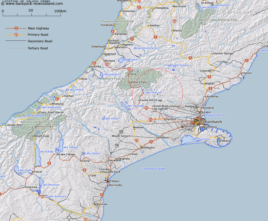
Map showing location of Salmon Creek


LINZ description: Stream rising West of Chest Peak, and flowing South-west into the Waimakariri River, on the left bank, 3km below Hamilton Rapids. Grasmere & Upper Ashley Survey Districts.
Latitude: -43.120671
Longitude: 172.000546
Northing: 5225300
Easting: 1518695.5
Land District: Canterbury
Feat Type: Stream


Scroll down to see a more detailed road map and below that a topographical map showing the location of Salmon Creek. The road map has been supplied by openstreetmap and the topographical map of Salmon Creek has been supplied by Land Information New Zealand (LINZ).

Yes you can use the top static map for you school/university project or personal website with a link back. Contact me for any commercial use.

Salmon Creek Map New Zealand


New Zealand places in our database
[ A ] [ B ] [ C ] [ D ] [ E ] [ F ] [ G ] [ H ] [ I ] [ J ] [ K ] [ L ] [ M ] [ N ] [ O ] [ P ] [ Q ] [ R ] [ S ] [ T ] [ U ] [ V ] [ W ] [ X ] [ Y ] [ Z ]


Closest 20 Streams to Salmon Creek

Mannering Stream ( 4.57km )   Chest Peak Stream ( 4.78km )   Newton Stream ( 5.74km )   Milton Stream ( 5.8km )   Broadleaf Stream ( 6.43km )   Millton Stream ( 6.57km )   Sailor Stream ( 6.72km )   Townshend River ( 6.74km )   Whistler River ( 6.91km )   Cunningham Stream ( 7.45km )   Shifton Stream ( 7.64km )   Letitia Stream ( 7.74km )   Storm Stream ( 9.57km )   Snowdale Stream ( 10.18km )   Dobson Stream ( 10.26km )   Brechin Burn ( 10.33km )   Puffers Stream ( 10.38km )   Moody Stream ( 10.56km )   Kinnebrooks Stream ( 10.97km )   Pember Stream ( 10.98km )   Harman Stream ( 11.07km )   Five Gully Stream ( 11.47km )   Foster Stream ( 11.88km )   Rocky Stream ( 12.01km )   Truscotts Stream ( 12.08km )   Blakistons Stream ( 12.35km )   Chasm Stream ( 12.4km )   Boundary Stream ( 12.52km )   Hungerford Stream ( 12.59km )   Coal Creek ( 12.62km )   Gooseberry Stream ( 13.2km )   Nomans Stream ( 13.29km )   Waterfall Stream ( 13.49km )   Waterfall Creek ( 13.5km )   Kingsdown Stream ( 13.74km )   Keats Stream ( 13.91km )   Slovens Stream ( 14.09km )   Ede Stream ( 14.17km )   Boundary Stream ( 14.29km )   Broom Stream ( 14.32km )