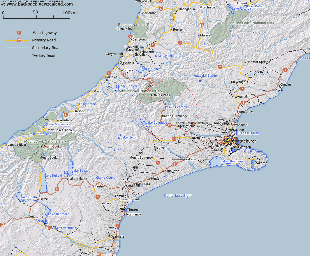
Map showing location of Bernard Stream


LINZ description: Leftt bank tributary of Winding Creek rising on the southern slopes of Mount Saint Bernard, flowing southward and joining Winding Creek 2.9km South-east of Flock Hill homestead. Blocks VI and X Grasmere Survey District.
Latitude: -43.129133
Longitude: 171.812493
Northing: 5224160.7
Easting: 1503410.7
Land District: Canterbury
Feat Type: Stream


Scroll down to see a more detailed road map and below that a topographical map showing the location of Bernard Stream. The road map has been supplied by openstreetmap and the topographical map of Bernard Stream has been supplied by Land Information New Zealand (LINZ).

Yes you can use the top static map for you school/university project or personal website with a link back. Contact me for any commercial use.

Bernard Stream Map New Zealand


New Zealand places in our database
[ A ] [ B ] [ C ] [ D ] [ E ] [ F ] [ G ] [ H ] [ I ] [ J ] [ K ] [ L ] [ M ] [ N ] [ O ] [ P ] [ Q ] [ R ] [ S ] [ T ] [ U ] [ V ] [ W ] [ X ] [ Y ] [ Z ]


Closest 20 Streams to Bernard Stream

Winding Creek ( 2.58km )   Rata Stream ( 3.59km )   Slovens Stream ( 4.29km )   Manson Creek ( 5.01km )   Milliken Stream ( 6.3km )   Craigieburn ( 6.37km )   Nomans Stream ( 6.92km )   Ribbonwood Stream ( 7.22km )   Puffers Stream ( 7.23km )   Flock Hill Stream ( 7.96km )   Gooseberry Stream ( 8.39km )   Iron Creek ( 8.44km )   Camp Stream ( 9.02km )   Poverty Stream ( 9.09km )   Broadleaf Stream ( 9.19km )   Broken River ( 9.41km )   Lansdowne Creek ( 9.49km )   Ede Stream ( 9.72km )   Emu Stream ( 10.28km )   Cass River ( 10.43km )   Snowslide Stream ( 10.47km )   Wall Creek ( 10.64km )   Cuckoo Creek ( 10.65km )   Adams Stream ( 11.05km )   Camp Stream ( 11.05km )   Long Valley Stream ( 11.13km )   Blackley Stream ( 11.22km )   Rocky Stream ( 11.34km )   Bush Stream ( 11.6km )   Truscotts Stream ( 11.69km )   Hogs Back Creek ( 11.76km )   Grasmere Stream ( 11.97km )   Tims Stream ( 12.14km )   Blakistons Stream ( 12.21km )   McLeod Stream ( 12.29km )   Thomas River ( 12.33km )   Otarama Stream ( 12.33km )   Misery Stream ( 12.48km )   Letitia Stream ( 12.55km )   Chasm Stream ( 12.63km )