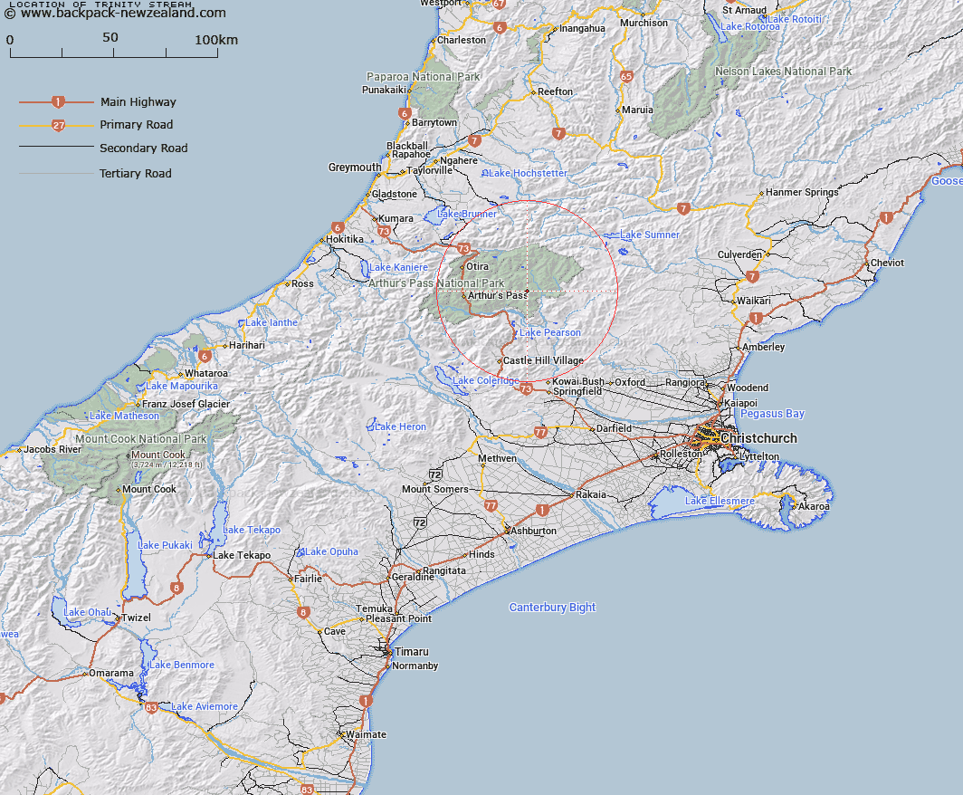
Map showing location of Trinity Stream


LINZ description: Right bank tributary of Surprise Stream rising 1.5km North of Brown Hill, flowing westward, and joining Surprise Stream 1km North-east of Casey Saddle. Block VI Hawdon Survey District.
Latitude: -42.923031
Longitude: 171.835058
Northing: 5247074.1
Easting: 1504928.5
Land District: Canterbury
Feat Type: Stream


Scroll down to see a more detailed road map and below that a topographical map showing the location of Trinity Stream. The road map has been supplied by openstreetmap and the topographical map of Trinity Stream has been supplied by Land Information New Zealand (LINZ).

Yes you can use the top static map for you school/university project or personal website with a link back. Contact me for any commercial use.

Trinity Stream Map New Zealand


New Zealand places in our database
[ A ] [ B ] [ C ] [ D ] [ E ] [ F ] [ G ] [ H ] [ I ] [ J ] [ K ] [ L ] [ M ] [ N ] [ O ] [ P ] [ Q ] [ R ] [ S ] [ T ] [ U ] [ V ] [ W ] [ X ] [ Y ] [ Z ]


Closest 20 Streams to Trinity Stream

Pampas Stream ( 1.27km )   Surprise Stream ( 1.43km )   Casey Stream ( 2.7km )   Mount Brown Creek ( 4.41km )   East Hawdon Stream ( 4.94km )   Cleland Stream ( 6.56km )   Andrews Stream ( 6.74km )   Poulter River East Branch ( 6.89km )   Hawdon River ( 7.54km )   Fenwick Stream ( 7.62km )   Riversdale Stream ( 7.69km )   Trudge Stream ( 7.79km )   Pete Stream ( 8.4km )   Turnbull Stream ( 8.41km )   Lower Farm Stream ( 8.47km )   Discovery Stream ( 8.93km )   Twin Fall Stream ( 9.26km )   Enchanted Stream ( 9.44km )   Beckett Stream ( 9.53km )   Minchin Stream ( 10.01km )   Ranger Stream ( 10.12km )   Otehake River East Branch ( 10.79km )   Row Stream ( 10.83km )   Chasm Stream ( 10.99km )   Sudden Valley Stream ( 11.04km )   Bush Stream ( 11.43km )   Morrison Stream ( 11.85km )   Boundary Stream ( 12.34km )   Poulter River ( 12.4km )   Tawhana Stream ( 12.87km )   Linwood Creek ( 12.91km )   Otehake River West Branch ( 13.28km )   Grasmere Stream ( 13.44km )   Cox River ( 13.59km )   Red Beech Stream ( 13.86km )   Montgomery Stream ( 14.05km )   Poverty Stream ( 14.05km )   Koropuku Creek ( 14.09km )   Cherrywood Creek ( 14.31km )   Cochran Stream ( 14.36km )