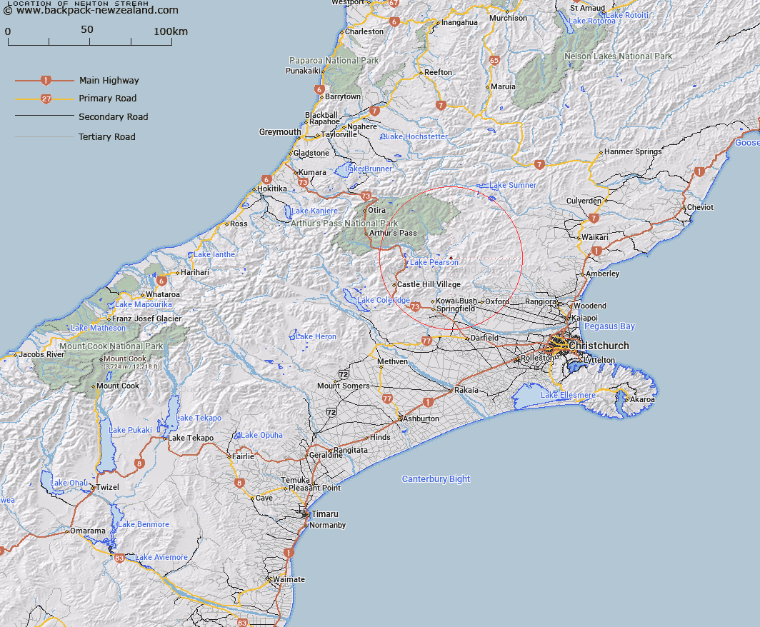
Map showing location of Newton Stream


LINZ description: Left bank tributary of Esk River rising West of Trig. M (Geodetic Code A9TT), flowing westwards and joining Esk River 750m downstream of Brechin Burn. Block I Upper Ashley Survey District.
Latitude: -43.071349
Longitude: 172.021407
Northing: 5230797.3
Easting: 1520328.5
Land District: Canterbury
Feat Type: Stream


Scroll down to see a more detailed road map and below that a topographical map showing the location of Newton Stream. The road map has been supplied by openstreetmap and the topographical map of Newton Stream has been supplied by Land Information New Zealand (LINZ).

Yes you can use the top static map for you school/university project or personal website with a link back. Contact me for any commercial use.

Newton Stream Map New Zealand


New Zealand places in our database
[ A ] [ B ] [ C ] [ D ] [ E ] [ F ] [ G ] [ H ] [ I ] [ J ] [ K ] [ L ] [ M ] [ N ] [ O ] [ P ] [ Q ] [ R ] [ S ] [ T ] [ U ] [ V ] [ W ] [ X ] [ Y ] [ Z ]


Closest 20 Streams to Newton Stream

Sailor Stream ( 4.02km )   Whistler River ( 4.14km )   Chest Peak Stream ( 4.32km )   Brechin Burn ( 4.63km )   Salmon Creek ( 5.74km )   Mannering Stream ( 5.78km )   Letitia Stream ( 6.56km )   Cunningham Stream ( 6.7km )   Hungerford Stream ( 6.94km )   Pember Stream ( 7.08km )   Baldy Stream ( 9.1km )   Milton Stream ( 9.97km )   Boundary Stream ( 10.03km )   Boundary Stream ( 10.14km )   Millton Stream ( 10.69km )   Broadleaf Stream ( 10.8km )   Snowdale Stream ( 10.89km )   Lillburn River ( 10.9km )   Lilburne River ( 10.9km )   Camp Stream ( 11.23km )   Shifton Stream ( 11.48km )   Townshend River ( 11.89km )   Esk River ( 12.62km )   Youngman Stream ( 12.95km )   Storm Stream ( 12.98km )   Gooseberry Stream ( 13.21km )   Five Gully Stream ( 13.41km )   Kingsdown Stream ( 13.47km )   Broom Stream ( 13.98km )   Turnbull Stream ( 14.65km )   Lochinvar Stream ( 14.73km )   Harman Stream ( 14.83km )   Pete Stream ( 14.89km )   Puffers Stream ( 15km )   P?kio Stream ( 15.06km )   Nigger Stream ( 15.06km )   Moody Stream ( 15.08km )   Poverty Stream ( 15.14km )   Dobson Stream ( 15.38km )   Flora Stream ( 15.57km )