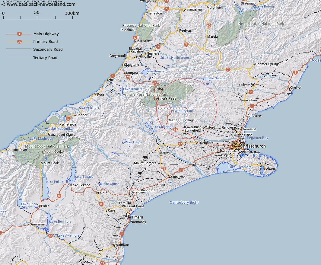
Map showing location of Sailor Stream


LINZ description: Right bank tributary of Esk River rising 1.7km South of Mount White [Trig. E (Geodetic Code A9XT)], flowing southward, East of Sugar Loaf and joining Esk River 2.4km upstream of Waimakariri River. Block IV, Grasmere Survey District.
Latitude: -43.063641
Longitude: 171.973019
Northing: 5231606.2
Easting: 1516378.6
Land District: Canterbury
Feat Type: Stream


Scroll down to see a more detailed road map and below that a topographical map showing the location of Sailor Stream. The road map has been supplied by openstreetmap and the topographical map of Sailor Stream has been supplied by Land Information New Zealand (LINZ).

Yes you can use the top static map for you school/university project or personal website with a link back. Contact me for any commercial use.

Sailor Stream Map New Zealand


New Zealand places in our database
[ A ] [ B ] [ C ] [ D ] [ E ] [ F ] [ G ] [ H ] [ I ] [ J ] [ K ] [ L ] [ M ] [ N ] [ O ] [ P ] [ Q ] [ R ] [ S ] [ T ] [ U ] [ V ] [ W ] [ X ] [ Y ] [ Z ]


Closest 20 Streams to Sailor Stream

Letitia Stream ( 2.62km )   Newton Stream ( 4.02km )   Brechin Burn ( 5.82km )   Salmon Creek ( 6.72km )   Boundary Stream ( 7.57km )   Chest Peak Stream ( 7.83km )   Whistler River ( 8.15km )   Mannering Stream ( 8.98km )   Hungerford Stream ( 9.04km )   Broadleaf Stream ( 9.17km )   Gooseberry Stream ( 9.24km )   Baldy Stream ( 9.36km )   Cunningham Stream ( 10.54km )   Camp Stream ( 10.73km )   Pember Stream ( 10.91km )   Poverty Stream ( 11.12km )   Pete Stream ( 11.31km )   Slovens Stream ( 11.97km )   Turnbull Stream ( 12.17km )   Bush Stream ( 12.21km )   Milton Stream ( 12.26km )   Millton Stream ( 13.02km )   Puffers Stream ( 13.17km )   Townshend River ( 13.46km )   Shifton Stream ( 14km )   Boundary Stream ( 14.04km )   Lillburn River ( 14.23km )   Lilburne River ( 14.23km )   Esk River ( 14.3km )   Poulter River East Branch ( 14.47km )   Lochinvar Stream ( 14.48km )   Snowdale Stream ( 14.58km )   Lower Farm Stream ( 14.8km )   Mount Brown Creek ( 14.88km )   Nigger Stream ( 14.93km )   P?kio Stream ( 14.93km )   Bernard Stream ( 14.93km )   Storm Stream ( 15.76km )   Winding Creek ( 15.88km )   Nomans Stream ( 16km )