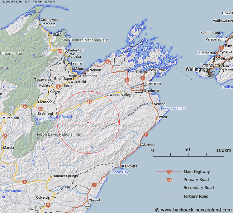
Map showing location of Fork Spur


LINZ description: A ridge in the headwaters of Waihopai River, opposite where Waterfall Stream meets the Waihopai
Latitude: -41.887276
Longitude: 173.284986
Northing: 5362700
Easting: 1623643.5
Land District: Marlborough
Feat Type: Ridge


Scroll down to see a more detailed road map and below that a topographical map showing the location of Fork Spur. The road map has been supplied by openstreetmap and the topographical map of Fork Spur has been supplied by Land Information New Zealand (LINZ).

Yes you can use the top static map for you school/university project or personal website with a link back. Contact me for any commercial use.

Fork Spur Map New Zealand


New Zealand places in our database
[ A ] [ B ] [ C ] [ D ] [ E ] [ F ] [ G ] [ H ] [ I ] [ J ] [ K ] [ L ] [ M ] [ N ] [ O ] [ P ] [ Q ] [ R ] [ S ] [ T ] [ U ] [ V ] [ W ] [ X ] [ Y ] [ Z ]


Closest 20 Ridges to Fork Spur

Canterbury Spur ( 3.38km )   Rocky Gill Spur ( 25.28km )   Scarecrow Spur ( 28.34km )   Saw Spur ( 29.18km )   Mangerton Ridge ( 29.32km )   The Black Spur ( 30.22km )   Red Hills Ridge ( 30.87km )   Junction Spur ( 31.68km )   Rough Spur ( 31.82km )   Tongue Spur ( 32.46km )   Saint Bernard Spur ( 33.28km )   The Carriage Drive ( 33.28km )   Porter Ridge ( 33.9km )   The Fingerpost ( 34.81km )   Big Benledi ( 34.99km )   Billys Spur ( 36.19km )   Stafford Ridge ( 36.7km )   Shoering Spur ( 38.18km )   McRae Spur ( 38.22km )   Fifteen Mile Spur ( 38.7km )   Red Spur ( 39.2km )   Prospect Ridge ( 39.2km )   Fidget Spur ( 40.67km )   Christie Ridge ( 40.95km )   Gibbs Spur ( 41.97km )   Robert Ridge ( 42.54km )   Davy Spur ( 42.7km )   Angelus Ridge ( 43.18km )   Bobs Spur ( 44.01km )   Turk Ridge ( 44.47km )   Ben Spur ( 44.93km )   Gibson Spur ( 45.19km )   The Castles ( 46.41km )   Balaclava Ridge ( 47km )   George Spur ( 47.22km )   Razorback Ridge ( 48.51km )   Hooper Ridge ( 48.91km )   Surveyor Spur ( 49.28km )   Inkerman Ridge ( 49.83km )   Snowflake Spur ( 50.22km )