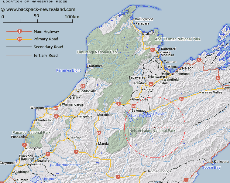
Map showing location of Mangerton Ridge
LINZ description: Mountain Ridge to the west of Coldwater Creek (a tributary of Wairau River), commencing in the Raglan Range at peak (2022m) reference Topo50 BS25 996521, running westward, then South-westward to height 1810m at reference Topo50 BS25 934450. Blocks IV and VII Rainbow, Block I Wairau, and Blocks XIV and XV Rotoiti Survey Districts.
Latitude: -41.98441
Longitude: 172.955436
Northing: 5351953.8
Easting: 1596308.4
Land District: Nelson
Feat Type: Ridge
Latitude: -41.98441
Longitude: 172.955436
Northing: 5351953.8
Easting: 1596308.4
Land District: Nelson
Feat Type: Ridge

Scroll down to see a more detailed road map and below that a topographical map showing the location of Mangerton Ridge. The road map has been supplied by openstreetmap and the topographical map of Mangerton Ridge has been supplied by Land Information New Zealand (LINZ).
Yes you can use the top static map for you school/university project or personal website with a link back. Contact me for any commercial use.
[ A ] [ B ] [ C ] [ D ] [ E ] [ F ] [ G ] [ H ] [ I ] [ J ] [ K ] [ L ] [ M ] [ N ] [ O ] [ P ] [ Q ] [ R ] [ S ] [ T ] [ U ] [ V ] [ W ] [ X ] [ Y ] [ Z ]