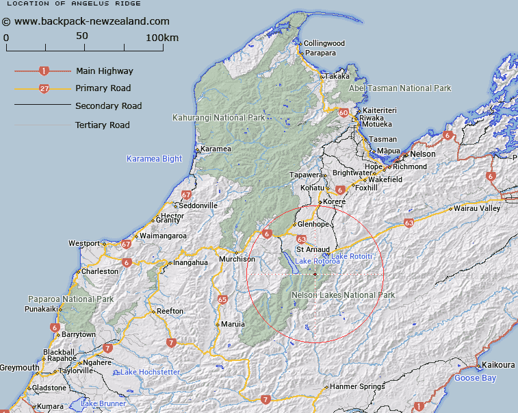
Map showing location of Angelus Ridge


LINZ description: Ridge on which Angelus Peak is situated. Blocks XI and XII Arnaud Survey District.
Latitude: -41.916346
Longitude: 172.764664
Northing: 5359485
Easting: 1580484.5
Land District: Nelson
Feat Type: Ridge


Scroll down to see a more detailed road map and below that a topographical map showing the location of Angelus Ridge. The road map has been supplied by openstreetmap and the topographical map of Angelus Ridge has been supplied by Land Information New Zealand (LINZ).

Yes you can use the top static map for you school/university project or personal website with a link back. Contact me for any commercial use.

Angelus Ridge Map New Zealand


New Zealand places in our database
[ A ] [ B ] [ C ] [ D ] [ E ] [ F ] [ G ] [ H ] [ I ] [ J ] [ K ] [ L ] [ M ] [ N ] [ O ] [ P ] [ Q ] [ R ] [ S ] [ T ] [ U ] [ V ] [ W ] [ X ] [ Y ] [ Z ]


Closest 20 Ridges to Angelus Ridge

Robert Ridge ( 6.06km )   Christie Ridge ( 7.14km )   Prospect Ridge ( 8.06km )   Fifteen Mile Spur ( 9.86km )   Franklin Ridge ( 16.66km )   Mangerton Ridge ( 17.5km )   Saw Spur ( 20.04km )   Turk Ridge ( 22.45km )   Stafford Ridge ( 24.02km )   Balaclava Ridge ( 28.73km )   Three Sisters ( 29.32km )   Paget Ridge ( 33.42km )   Inkerman Ridge ( 34.5km )   Porter Ridge ( 36.44km )   Red Hills Ridge ( 36.79km )   The Fingerpost ( 37.28km )   Sebastopol Ridge ( 37.94km )   Blue Cliffs Ridge ( 39.19km )   Cardigan Ridge ( 41.32km )   Long Spur ( 42.01km )   Fork Spur ( 43.18km )   Pass Spur ( 43.27km )   Newton Ridge ( 43.35km )   Canterbury Spur ( 43.62km )   The Battery ( 45.63km )   Bald Knob Ridge ( 46.97km )   Gibbs Spur ( 49.03km )   Saddle Spur ( 50.99km )   Deepdale Ridge ( 53.56km )   Big Benledi ( 56.61km )   Rough Spur ( 58.34km )   Jones Ridge ( 58.58km )   Saint Bernard Spur ( 60km )   The Burnt Spur ( 61.87km )   Scarecrow Spur ( 63.4km )   The Black Spur ( 64.53km )   Razorback ( 64.61km )   Johnson Ridge ( 65.44km )   Mount Gorgeous Range ( 65.44km )   Luna Ridge ( 65.92km )