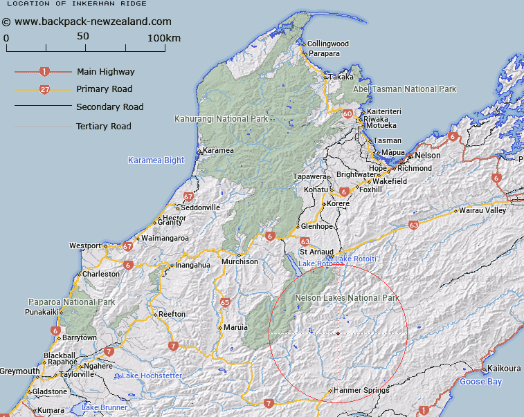
Map showing location of Inkerman Ridge
LINZ description: Mountain ridge to the north of Crimea Creek and extending from the Crimea Range at reference Topo50 BT24 86028, generally eastward to height 1375m, 1km North North-west of the junction of Crimea Creek and Alma River. Blocks VI and VII Alma Survey District.
Latitude: -42.215736
Longitude: 172.874496
Northing: 5326262.8
Easting: 1589641.2
Land District: Nelson
Feat Type: Ridge
Latitude: -42.215736
Longitude: 172.874496
Northing: 5326262.8
Easting: 1589641.2
Land District: Nelson
Feat Type: Ridge

Scroll down to see a more detailed road map and below that a topographical map showing the location of Inkerman Ridge. The road map has been supplied by openstreetmap and the topographical map of Inkerman Ridge has been supplied by Land Information New Zealand (LINZ).
Yes you can use the top static map for you school/university project or personal website with a link back. Contact me for any commercial use.
[ A ] [ B ] [ C ] [ D ] [ E ] [ F ] [ G ] [ H ] [ I ] [ J ] [ K ] [ L ] [ M ] [ N ] [ O ] [ P ] [ Q ] [ R ] [ S ] [ T ] [ U ] [ V ] [ W ] [ X ] [ Y ] [ Z ]