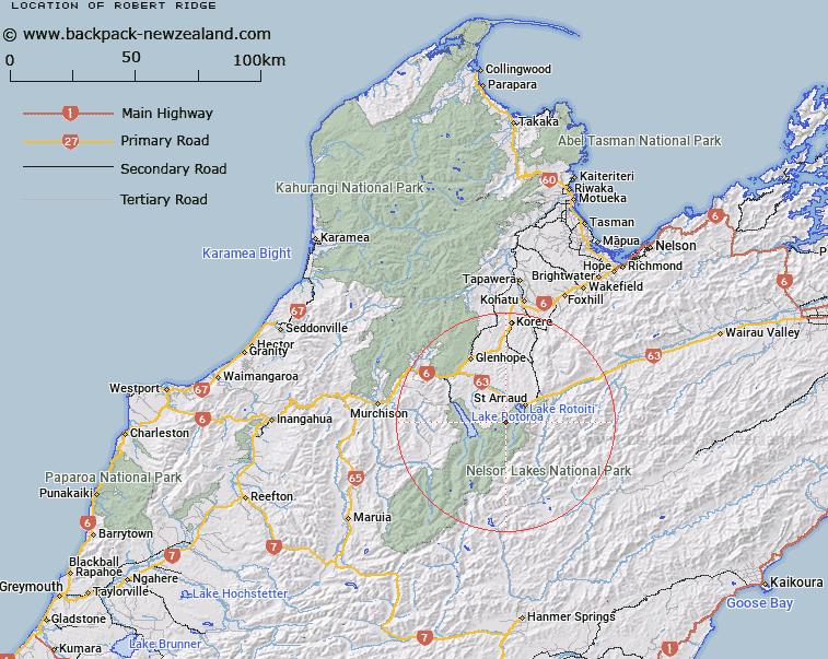
Map showing location of Robert Ridge


LINZ description: From Lake Rotoiti to Mount Cedric
Latitude: -41.862185
Longitude: 172.772278
Northing: 5365500
Easting: 1581100
Land District: Nelson
Feat Type: Ridge


Scroll down to see a more detailed road map and below that a topographical map showing the location of Robert Ridge. The road map has been supplied by openstreetmap and the topographical map of Robert Ridge has been supplied by Land Information New Zealand (LINZ).

Yes you can use the top static map for you school/university project or personal website with a link back. Contact me for any commercial use.

Robert Ridge Map New Zealand


New Zealand places in our database
[ A ] [ B ] [ C ] [ D ] [ E ] [ F ] [ G ] [ H ] [ I ] [ J ] [ K ] [ L ] [ M ] [ N ] [ O ] [ P ] [ Q ] [ R ] [ S ] [ T ] [ U ] [ V ] [ W ] [ X ] [ Y ] [ Z ]


Closest 20 Ridges to Robert Ridge

Christie Ridge ( 1.82km )   Prospect Ridge ( 3.55km )   Angelus Ridge ( 6.06km )   Fifteen Mile Spur ( 14.87km )   Mangerton Ridge ( 20.36km )   Franklin Ridge ( 22.52km )   Saw Spur ( 23.26km )   Turk Ridge ( 28.16km )   Stafford Ridge ( 28.81km )   Porter Ridge ( 31.37km )   Three Sisters ( 31.89km )   Red Hills Ridge ( 32.04km )   Balaclava Ridge ( 34.44km )   Blue Cliffs Ridge ( 36.64km )   Paget Ridge ( 39.42km )   Inkerman Ridge ( 40.21km )   Newton Ridge ( 41.3km )   The Fingerpost ( 41.47km )   Fork Spur ( 42.54km )   Bald Knob Ridge ( 42.69km )   Canterbury Spur ( 43.44km )   Gibbs Spur ( 43.68km )   Sebastopol Ridge ( 43.7km )   Cardigan Ridge ( 47.27km )   Long Spur ( 48.06km )   Pass Spur ( 49.32km )   The Battery ( 51.67km )   Jones Ridge ( 52.72km )   Deepdale Ridge ( 53.59km )   Saddle Spur ( 56.96km )   Big Benledi ( 59.7km )   Luna Ridge ( 60.64km )   Rough Spur ( 60.89km )   Johnson Ridge ( 61.46km )   Mount Gorgeous Range ( 61.46km )   Saint Bernard Spur ( 62.58km )   Webb Ridge ( 62.93km )   Cowin Spur ( 64.45km )   Scarecrow Spur ( 64.91km )   Kendall Ridge ( 66.07km )