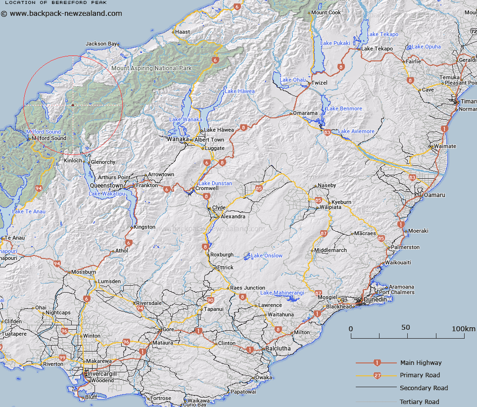
Map showing location of Beresford Peak


LINZ description: Peak between Olivine and Barrier Rivers, in the headwaters of the Diorite Stream, north west of the Barrier Range.
Latitude: -44.420483
Longitude: 168.263017
Northing: 5070500
Easting: 1222900
Land District: Otago
Feat Type: Hill


Scroll down to see a more detailed road map and below that a topographical map showing the location of Beresford Peak. The road map has been supplied by openstreetmap and the topographical map of Beresford Peak has been supplied by Land Information New Zealand (LINZ).

Yes you can use the top static map for you school/university project or personal website with a link back. Contact me for any commercial use.

Beresford Peak Map New Zealand


New Zealand places in our database
[ A ] [ B ] [ C ] [ D ] [ E ] [ F ] [ G ] [ H ] [ I ] [ J ] [ K ] [ L ] [ M ] [ N ] [ O ] [ P ] [ Q ] [ R ] [ S ] [ T ] [ U ] [ V ] [ W ] [ X ] [ Y ] [ Z ]


Closest 20 Hills to Beresford Peak

Beresford Peak ( 0km )   Alexander ( 2.5km )   Todd ( 3.15km )   Angle Peak ( 3.66km )   McClimont Peak ( 3.84km )   Antoinette Mountain ( 4.1km )   Annetta Mountain ( 5.71km )   Little Red Hill ( 5.75km )   Elespie ( 6.3km )   Allison Mountain ( 6.59km )   Battlement Peak ( 7km )   Pic d'argent ( 7.19km )   Ark ( 7.4km )   Blockade Peak ( 7.53km )   Darkness Peak ( 7.79km )   Little Ark ( 8.06km )   The Tower ( 8.07km )   Gates Mountain ( 8.39km )   Key Rock ( 8.43km )   Terminal Peak ( 8.68km )   Gyrae ( 8.92km )   Beacon ( 9.02km )   Climax Peak ( 9.06km )   Irvine Peak ( 9.19km )   Mallory Peak ( 9.46km )   Futurity Rock ( 9.78km )   Betty Peak ( 9.81km )   Sunset Peak ( 10.03km )   Farrell Peak ( 10.09km )   Passchendaele Peak ( 10.12km )   Daedelus ( 10.16km )   Destiny Peak ( 10.18km )   Albert Peak ( 10.2km )   Corinna Peak ( 10.29km )   Brenda Peak ( 10.43km )   Mount Pyke ( 10.51km )   Gino Peak ( 10.71km )   Gable Peak ( 10.76km )   Trinity ( 10.94km )   Watkins ( 10.98km )