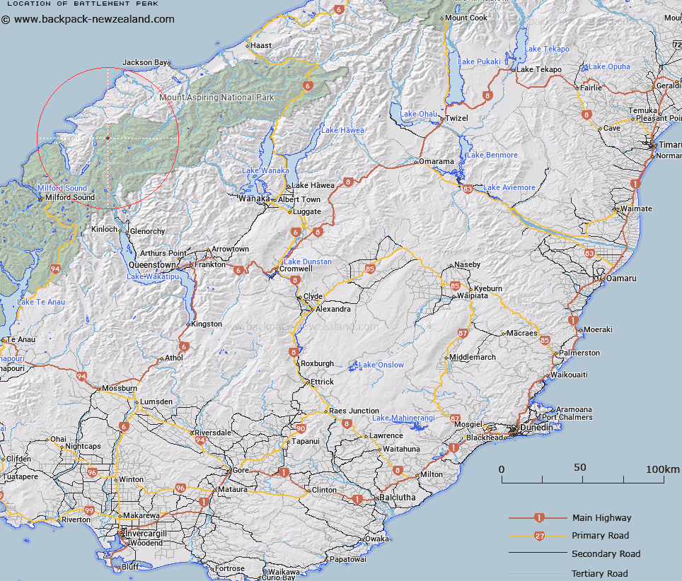
Map showing location of Battlement Peak


LINZ description: Lying between Beacon Peak to the north and Alison Peak to the south
Latitude: -44.359197
Longitude: 168.283026
Northing: 5077400
Easting: 1224100
Land District: Otago
Feat Type: Hill


Scroll down to see a more detailed road map and below that a topographical map showing the location of Battlement Peak. The road map has been supplied by openstreetmap and the topographical map of Battlement Peak has been supplied by Land Information New Zealand (LINZ).

Yes you can use the top static map for you school/university project or personal website with a link back. Contact me for any commercial use.

Battlement Peak Map New Zealand


New Zealand places in our database
[ A ] [ B ] [ C ] [ D ] [ E ] [ F ] [ G ] [ H ] [ I ] [ J ] [ K ] [ L ] [ M ] [ N ] [ O ] [ P ] [ Q ] [ R ] [ S ] [ T ] [ U ] [ V ] [ W ] [ X ] [ Y ] [ Z ]


Closest 20 Hills to Battlement Peak

Allison Mountain ( 0.41km )   Annetta Mountain ( 1.44km )   Little Red Hill ( 1.73km )   Beacon ( 2.02km )   Antoinette Mountain ( 3.04km )   Elespie ( 4.51km )   Red Mountain ( 6.52km )   Beresford Peak ( 7km )   Darkness Peak ( 7.33km )   Alexander ( 7.59km )   Pic d'argent ( 7.66km )   Gyrae ( 7.75km )   Farrell Peak ( 7.8km )   Picador ( 7.91km )   The Knoll ( 8.03km )   Todd ( 8.06km )   Trinity ( 8.56km )   Ark ( 8.62km )   McClimont Peak ( 8.65km )   Matador ( 8.98km )   Little Ark ( 8.99km )   Telescope Hill ( 9.09km )   Tempest Peak ( 9.57km )   The Tower ( 9.74km )   Mount Temple ( 9.8km )   Angle Peak ( 9.91km )   Typhoon Peak ( 9.96km )   Holloway Peak ( 9.98km )   Toreador Peak ( 10.16km )   Mount Pyke ( 10.27km )   Futurity Rock ( 10.42km )   Retreat Peaks ( 11.14km )   Blockade Peak ( 11.31km )   Mount Beck ( 11.67km )   Slip Hill ( 11.72km )   Gable Peak ( 11.73km )   Redoubt Peaks ( 12.09km )   Passchendaele Peak ( 12.35km )   Key Rock ( 12.52km )   Climax Peak ( 12.65km )