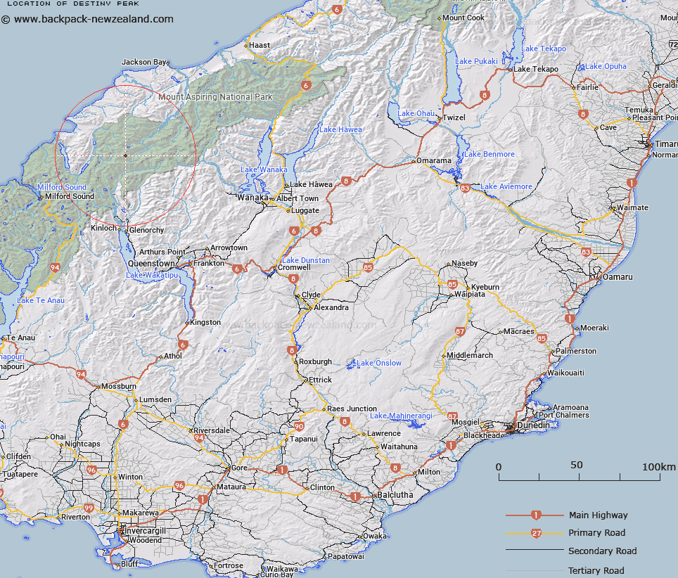
Map showing location of Destiny Peak


LINZ description: Peak east of Climax Peak, above the Twin Icefall which feeds Joe Glacier, north of Barrier Range.
Latitude: -44.454181
Longitude: 168.3822
Northing: 5067300
Easting: 1232600
Land District: Otago
Feat Type: Hill


Scroll down to see a more detailed road map and below that a topographical map showing the location of Destiny Peak. The road map has been supplied by openstreetmap and the topographical map of Destiny Peak has been supplied by Land Information New Zealand (LINZ).

Yes you can use the top static map for you school/university project or personal website with a link back. Contact me for any commercial use.

Destiny Peak Map New Zealand


New Zealand places in our database
[ A ] [ B ] [ C ] [ D ] [ E ] [ F ] [ G ] [ H ] [ I ] [ J ] [ K ] [ L ] [ M ] [ N ] [ O ] [ P ] [ Q ] [ R ] [ S ] [ T ] [ U ] [ V ] [ W ] [ X ] [ Y ] [ Z ]


Closest 20 Hills to Destiny Peak

Daedelus ( 0.35km )   Climax Peak ( 1.36km )   Passchendaele Peak ( 1.43km )   Key Rock ( 2.35km )   Blockade Peak ( 2.7km )   Gable Peak ( 3.47km )   The Tower ( 3.57km )   Buttress ( 3.62km )   Gates Mountain ( 4.08km )   Futurity Rock ( 4.13km )   Little Ark ( 4.53km )   Watkins ( 4.59km )   Ark ( 4.67km )   Stefansson Peak ( 4.71km )   Johansen Peak ( 4.74km )   Nansen Peak ( 5.01km )   Gino Peak ( 5.22km )   Chancellor ( 5.32km )   Pyramid ( 5.4km )   Pic d'argent ( 5.72km )   Frobisher Mountain ( 5.86km )   Mount Peary ( 6.07km )   Albert Peak ( 6.15km )   Betty Peak ( 6.23km )   McClimont Peak ( 6.35km )   Mount Victoria ( 6.39km )   Darkness Peak ( 6.46km )   Hedin Peak ( 6.64km )   Gyrae ( 6.91km )   Todd ( 7.03km )   Camp Oven Dome ( 7.17km )   Angle Peak ( 7.51km )   Alexander ( 7.69km )   Mallory Peak ( 7.85km )   Ferrier Peak ( 7.97km )   Irvine Peak ( 8.08km )   Bernard Peak ( 8.1km )   Farrell Peak ( 8.24km )   Mount Ian ( 8.26km )   Five Fingers ( 8.26km )