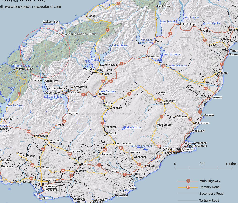
Map showing location of Gable Peak


LINZ description: Peak at the junction of the Olivine and Five Fingers Range above the Olivine Ice Plateau.
Latitude: -44.425125
Longitude: 168.398311
Northing: 5070600
Easting: 1233700
Land District: Otago
Feat Type: Hill


Scroll down to see a more detailed road map and below that a topographical map showing the location of Gable Peak. The road map has been supplied by openstreetmap and the topographical map of Gable Peak has been supplied by Land Information New Zealand (LINZ).

Yes you can use the top static map for you school/university project or personal website with a link back. Contact me for any commercial use.

Gable Peak Map New Zealand


New Zealand places in our database
[ A ] [ B ] [ C ] [ D ] [ E ] [ F ] [ G ] [ H ] [ I ] [ J ] [ K ] [ L ] [ M ] [ N ] [ O ] [ P ] [ Q ] [ R ] [ S ] [ T ] [ U ] [ V ] [ W ] [ X ] [ Y ] [ Z ]


Closest 20 Hills to Gable Peak

Buttress ( 1.16km )   Futurity Rock ( 1.31km )   Passchendaele Peak ( 2.06km )   Pyramid ( 2.52km )   The Tower ( 2.69km )   Little Ark ( 2.91km )   Daedelus ( 3.12km )   Destiny Peak ( 3.47km )   Ark ( 3.49km )   Pic d'argent ( 4.19km )   Camp Oven Dome ( 4.29km )   Gyrae ( 4.31km )   Climax Peak ( 4.37km )   Darkness Peak ( 4.41km )   Blockade Peak ( 4.77km )   Key Rock ( 5.24km )   Farrell Peak ( 5.29km )   Trinity ( 5.3km )   Mount Temple ( 5.3km )   Five Fingers ( 5.52km )   Holloway Peak ( 5.63km )   Tempest Peak ( 6.4km )   Typhoon Peak ( 6.51km )   Toreador Peak ( 7.12km )   Gates Mountain ( 7.17km )   Mount Victoria ( 7.2km )   Elespie ( 7.23km )   McClimont Peak ( 7.35km )   Matador ( 7.35km )   Picador ( 7.6km )   Todd ( 7.83km )   Nansen Peak ( 7.95km )   Chancellor ( 8.05km )   Watkins ( 8.07km )   Johansen Peak ( 8.08km )   Frobisher Mountain ( 8.13km )   Stefansson Peak ( 8.18km )   Alexander ( 8.35km )   Mount Peary ( 8.57km )   Gino Peak ( 8.67km )