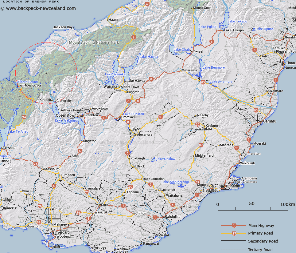
Map showing location of Brenda Peak


LINZ description: Peak north of Fohn Saddle in the headwaters of Beans Burn between the Bryneira and Barrier Ranges.
Latitude: -44.513779
Longitude: 168.276836
Northing: 5060200
Easting: 1224600
Land District: Otago
Feat Type: Hill


Scroll down to see a more detailed road map and below that a topographical map showing the location of Brenda Peak. The road map has been supplied by openstreetmap and the topographical map of Brenda Peak has been supplied by Land Information New Zealand (LINZ).

Yes you can use the top static map for you school/university project or personal website with a link back. Contact me for any commercial use.

Brenda Peak Map New Zealand


New Zealand places in our database
[ A ] [ B ] [ C ] [ D ] [ E ] [ F ] [ G ] [ H ] [ I ] [ J ] [ K ] [ L ] [ M ] [ N ] [ O ] [ P ] [ Q ] [ R ] [ S ] [ T ] [ U ] [ V ] [ W ] [ X ] [ Y ] [ Z ]


Closest 20 Hills to Brenda Peak

Brenda Peak ( 0km )   Corinna Peak ( 0.32km )   Sunset Peak ( 0.75km )   Fohn Peak ( 1.08km )   Terminal Peak ( 2.2km )   Irvine Peak ( 2.59km )   Mallory Peak ( 2.83km )   Bride Peaks ( 3.43km )   McBride Peaks ( 3.43km )   Betty Peak ( 4.6km )   Tantalus Peak ( 4.79km )   Albert Peak ( 4.86km )   Fiery Peak ( 5.12km )   Hedin Peak ( 5.65km )   Gino Peak ( 6.1km )   East Peak ( 6.25km )   West Peak ( 6.41km )   Niobe Peak ( 6.46km )   Gates Mountain ( 6.64km )   Courtenay Peak ( 6.71km )   Watkins ( 6.93km )   Stefansson Peak ( 7.07km )   Welshman Peak ( 7.17km )   Angle Peak ( 7.34km )   Poseidon Peak ( 7.97km )   Barrington Peak ( 8.25km )   Sarpedon ( 8.43km )   Key Rock ( 8.55km )   Johansen Peak ( 8.55km )   McClimont Peak ( 9.06km )   Blockade Peak ( 9.16km )   Todd ( 9.42km )   Climax Peak ( 9.48km )   Frenchman Peak ( 9.59km )   Alexander ( 9.73km )   Nansen Peak ( 10.26km )   Beresford Peak ( 10.43km )   Destiny Peak ( 10.67km )   Amphion Peak ( 10.79km )   Mount Chaos ( 10.92km )