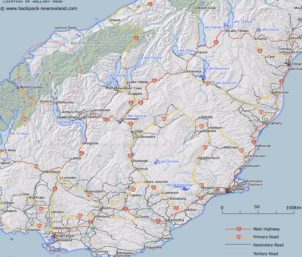
Map showing location of Mallory Peak


LINZ description: Peak on the Barrier Range east of Irvine Peak at the head of the Beans Burn and the Merkl Glacier.
Latitude: -44.499703
Longitude: 168.306553
Northing: 5061900
Easting: 1226872
Land District: Otago
Feat Type: Hill


Scroll down to see a more detailed road map and below that a topographical map showing the location of Mallory Peak. The road map has been supplied by openstreetmap and the topographical map of Mallory Peak has been supplied by Land Information New Zealand (LINZ).

Yes you can use the top static map for you school/university project or personal website with a link back. Contact me for any commercial use.

Mallory Peak Map New Zealand


New Zealand places in our database
[ A ] [ B ] [ C ] [ D ] [ E ] [ F ] [ G ] [ H ] [ I ] [ J ] [ K ] [ L ] [ M ] [ N ] [ O ] [ P ] [ Q ] [ R ] [ S ] [ T ] [ U ] [ V ] [ W ] [ X ] [ Y ] [ Z ]


Closest 20 Hills to Mallory Peak

Mallory Peak ( 0km )   Irvine Peak ( 0.43km )   Terminal Peak ( 1.4km )   Betty Peak ( 1.82km )   Albert Peak ( 2.16km )   McBride Peaks ( 2.74km )   Bride Peaks ( 2.74km )   Brenda Peak ( 2.83km )   Corinna Peak ( 3.02km )   Sunset Peak ( 3.25km )   Hedin Peak ( 3.41km )   Gino Peak ( 3.41km )   Fohn Peak ( 3.85km )   Gates Mountain ( 3.87km )   Watkins ( 4.22km )   Stefansson Peak ( 4.4km )   Key Rock ( 5.8km )   Angle Peak ( 5.91km )   Johansen Peak ( 6km )   Blockade Peak ( 6.52km )   Climax Peak ( 6.69km )   McClimont Peak ( 7.18km )   Tantalus Peak ( 7.57km )   Todd ( 7.69km )   Nansen Peak ( 7.73km )   West Peak ( 7.8km )   East Peak ( 7.84km )   Destiny Peak ( 7.85km )   Fiery Peak ( 7.95km )   Alexander ( 8.15km )   Daedelus ( 8.15km )   Chancellor ( 8.44km )   Passchendaele Peak ( 9.07km )   Niobe Peak ( 9.07km )   Mount Peary ( 9.3km )   Courtenay Peak ( 9.43km )   Beresford Peak ( 9.46km )   The Tower ( 9.53km )   Frobisher Mountain ( 9.75km )   Welshman Peak ( 9.98km )