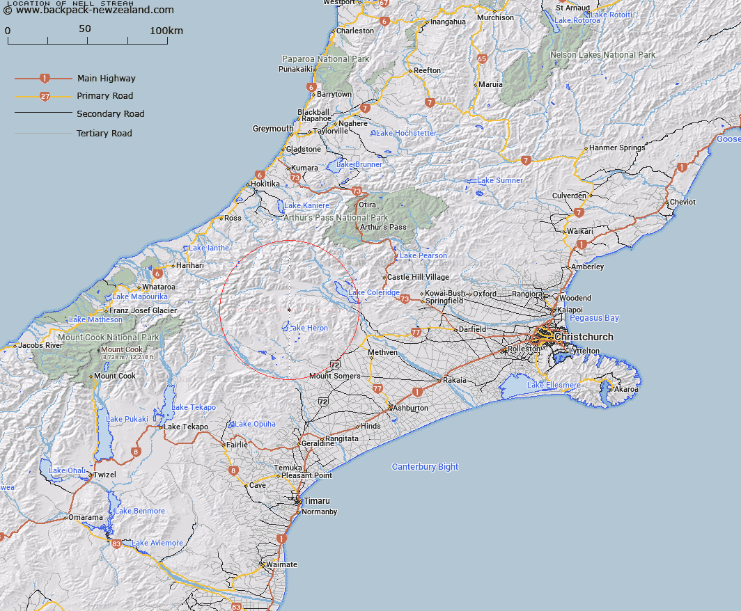
Map showing location of Nell Stream


LINZ description: Rises approximately 3miles east of Shaggy Hill and flows south west into swampy area of Lake Stream about 1 1/2miles south of Charlie Stream.
Latitude: -43.380933
Longitude: 171.195146
Northing: 5195300
Easting: 1453800
Land District: Canterbury
Feat Type: Stream


Scroll down to see a more detailed road map and below that a topographical map showing the location of Nell Stream. The road map has been supplied by openstreetmap and the topographical map of Nell Stream has been supplied by Land Information New Zealand (LINZ).

Yes you can use the top static map for you school/university project or personal website with a link back. Contact me for any commercial use.

Nell Stream Map New Zealand


New Zealand places in our database
[ A ] [ B ] [ C ] [ D ] [ E ] [ F ] [ G ] [ H ] [ I ] [ J ] [ K ] [ L ] [ M ] [ N ] [ O ] [ P ] [ Q ] [ R ] [ S ] [ T ] [ U ] [ V ] [ W ] [ X ] [ Y ] [ Z ]


Closest 20 Streams to Nell Stream

Charlie Stream ( 1.38km )   Ribbonwood Stream ( 2.11km )   Lake Stream ( 3.83km )   Leach Stream ( 3.93km )   Smite River ( 4.69km )   Lawsley Stream ( 5.4km )   Godley Stream ( 5.56km )   Shingly Creek ( 7.16km )   Glenfalloch Stream ( 7.83km )   Home Creek ( 7.86km )   Bush Creek ( 7.88km )   Polhill Stream ( 8.23km )   Station Creek ( 9.26km )   Dunbar Stream ( 10.21km )   Strone Stream ( 10.33km )   Round Hill Creek ( 10.51km )   Petticoat Lane ( 10.61km )   Triangle Stream ( 10.97km )   Cameron River ( 10.99km )   Colonel Stream ( 11.12km )   Lochiel Stream ( 11.15km )   Mellish Stream ( 11.28km )   Washbourne Creek ( 11.33km )   Swin River ( 11.61km )   Logan Stream ( 11.77km )   Gerard Stream ( 11.91km )   Big Fan Creek ( 12.01km )   Broad Creek ( 12.09km )   Barnard Stream ( 12.22km )   Lochaber Stream ( 12.48km )   Swin River North Branch ( 12.76km )   Double Hill Stream ( 12.77km )   Glenariffe Stream ( 12.84km )   Twin Creek ( 13.1km )   Jellicoe Stream ( 13.14km )   Olliver Stream ( 13.14km )   Maxwell Stream ( 13.2km )   Rocky Spur Creek ( 13.21km )   Swin River South Branch ( 13.55km )   Turtons Stream ( 13.7km )