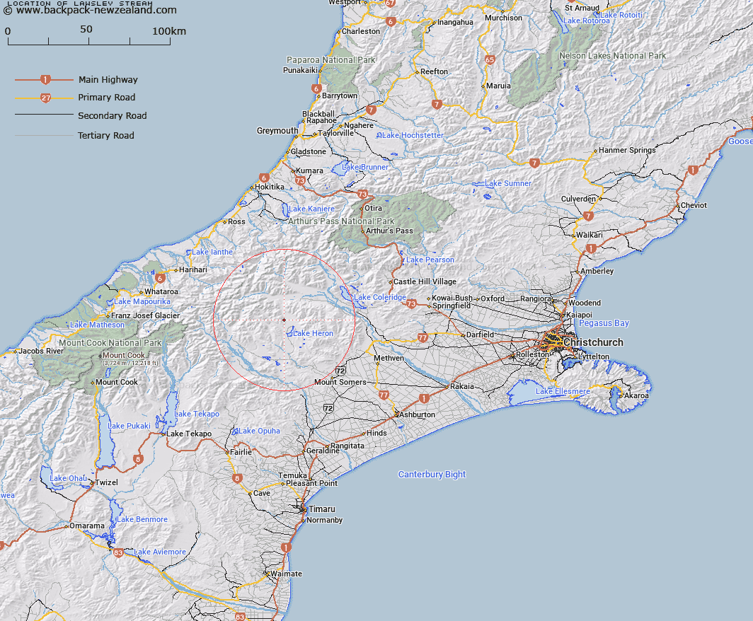
Map showing location of Lawsley Stream


LINZ description: Stream rising north of Staces Hill flows east into Lake Stream approximately 3 miles north of Lake Heron
Latitude: -43.408565
Longitude: 171.14012
Northing: 5192133.2
Easting: 1449411
Land District: Canterbury
Feat Type: Stream


Scroll down to see a more detailed road map and below that a topographical map showing the location of Lawsley Stream. The road map has been supplied by openstreetmap and the topographical map of Lawsley Stream has been supplied by Land Information New Zealand (LINZ).

Yes you can use the top static map for you school/university project or personal website with a link back. Contact me for any commercial use.

Lawsley Stream Map New Zealand


New Zealand places in our database
[ A ] [ B ] [ C ] [ D ] [ E ] [ F ] [ G ] [ H ] [ I ] [ J ] [ K ] [ L ] [ M ] [ N ] [ O ] [ P ] [ Q ] [ R ] [ S ] [ T ] [ U ] [ V ] [ W ] [ X ] [ Y ] [ Z ]


Closest 20 Streams to Lawsley Stream

Polhill Stream ( 2.85km )   Lake Stream ( 3.76km )   Charlie Stream ( 4.88km )   Nell Stream ( 5.4km )   Strone Stream ( 5.48km )   Ribbonwood Stream ( 6km )   Cameron River ( 6.15km )   Dunbar Stream ( 6.53km )   Leach Stream ( 6.57km )   Bush Creek ( 6.66km )   Lochiel Stream ( 6.7km )   Triangle Stream ( 6.83km )   Smite River ( 7.86km )   Home Creek ( 8.68km )   Olliver Stream ( 8.95km )   Lochaber Stream ( 8.95km )   Godley Stream ( 9.75km )   Swin River ( 9.87km )   Spean Stream ( 9.89km )   Mellish Stream ( 10.58km )   Washbourne Creek ( 10.65km )   Stumpy Stream ( 11.07km )   Red Moutain Stream ( 11.39km )   Shingly Creek ( 11.55km )   Glenfalloch Stream ( 12.44km )   Swin River North Branch ( 12.6km )   Swin River South Branch ( 13.07km )   Clent Hills Stream ( 13.13km )   Round Hill Creek ( 13.51km )   Maxwell Stream ( 13.84km )   Jagged Stream ( 13.93km )   Harding Stream ( 13.98km )   Sparrow Hawk Stream ( 14.08km )   Logan Stream ( 14.44km )   Station Creek ( 14.49km )   Jellicoe Stream ( 14.61km )   Rocky Spur Creek ( 15.18km )   Broad Creek ( 15.23km )   Barnard Stream ( 15.34km )   Petticoat Lane ( 15.34km )