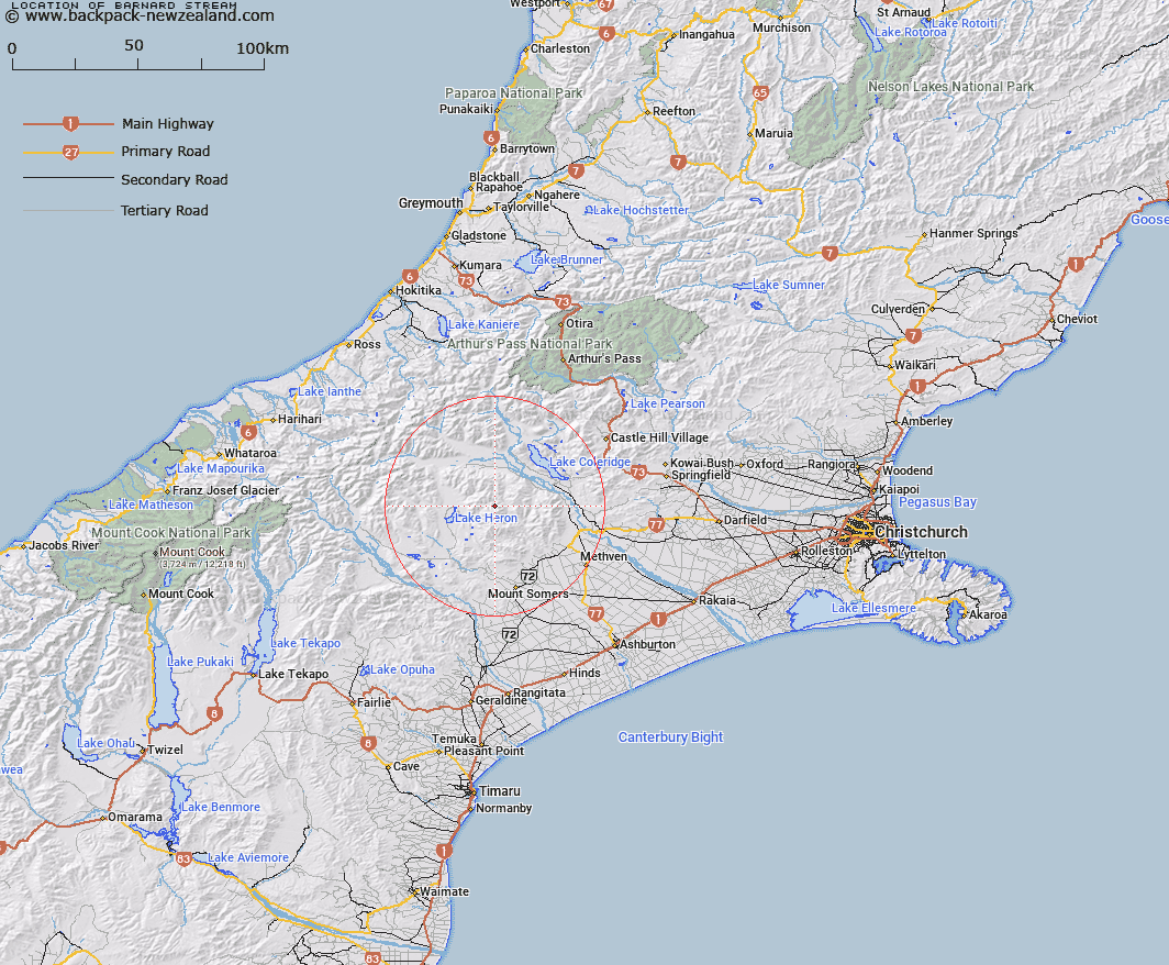
Map showing location of Barnard Stream


LINZ description: Right bank tributary of the Round Hill Creek rising 1.6km East by North-east of Trig. E (Geodetic Code AN5V), flowing northward and joining the Round Hill Creek 1.5km upstream of North Branch Ashburton River. Block II Somers Survey District.
Latitude: -43.43562
Longitude: 171.32636
Northing: 5189448.1
Easting: 1464551
Land District: Canterbury
Feat Type: Stream


Scroll down to see a more detailed road map and below that a topographical map showing the location of Barnard Stream. The road map has been supplied by openstreetmap and the topographical map of Barnard Stream has been supplied by Land Information New Zealand (LINZ).

Yes you can use the top static map for you school/university project or personal website with a link back. Contact me for any commercial use.

Barnard Stream Map New Zealand


New Zealand places in our database
[ A ] [ B ] [ C ] [ D ] [ E ] [ F ] [ G ] [ H ] [ I ] [ J ] [ K ] [ L ] [ M ] [ N ] [ O ] [ P ] [ Q ] [ R ] [ S ] [ T ] [ U ] [ V ] [ W ] [ X ] [ Y ] [ Z ]


Closest 20 Streams to Barnard Stream

Logan Stream ( 1.48km )   Round Hill Creek ( 1.83km )   Kings Drive Stream ( 5.03km )   Turtons Stream ( 5.11km )   Petticoat Lane ( 5.94km )   Maxwell Stream ( 6.7km )   Godley Stream ( 6.81km )   Home Creek ( 7.48km )   Comyns Stream ( 7.5km )   Smite River ( 7.73km )   Boundary Creek ( 7.92km )   Swin River North Branch ( 8.45km )   Ensor Stream ( 8.64km )   Middle Creek ( 9.04km )   Swin River South Branch ( 9.36km )   Mellish Stream ( 9.39km )   Taylors Stream ( 9.83km )   Ribbonwood Stream ( 10.26km )   Gerard Stream ( 10.32km )   Finger Stream ( 10.58km )   Swift River ( 10.59km )   Donald Stream ( 11.18km )   Swin River ( 11.47km )   Glenrock Stream ( 11.5km )   Nell Stream ( 12.22km )   Packers Creek ( 12.28km )   Colonel Stream ( 12.57km )   Redcliffe Stream ( 12.62km )   Isaac Stream ( 12.69km )   McLennan Creek ( 12.75km )   Snowy Stream ( 12.8km )   Ribbonwood Stream ( 13.21km )   Glenariffe Stream ( 13.22km )   Saddle Creek ( 13.33km )   Charlie Stream ( 13.59km )   Black Stream ( 13.83km )   Jack Stream ( 14km )   Double Hill Stream ( 14.37km )   Station Creek ( 14.44km )   Waterfall Creek ( 14.51km )