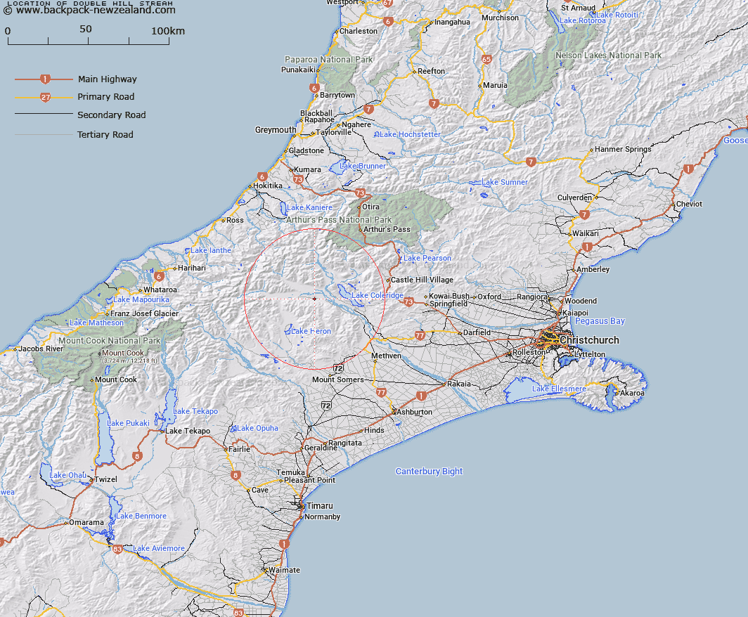
Map showing location of Double Hill Stream


LINZ description: Right bank tributary of Rakaia River rising in the Palmer Range 400m North of Mount O'Connor, flowing northward then eastward and joining Rakaia River 900m North of Glenaan Homestead. Blocks IV, V, and VI Glenrock Survey District.
Latitude: -43.306651
Longitude: 171.315517
Northing: 5203753.6
Easting: 1463384.1
Land District: Canterbury
Feat Type: Stream


Scroll down to see a more detailed road map and below that a topographical map showing the location of Double Hill Stream. The road map has been supplied by openstreetmap and the topographical map of Double Hill Stream has been supplied by Land Information New Zealand (LINZ).

Yes you can use the top static map for you school/university project or personal website with a link back. Contact me for any commercial use.

Double Hill Stream Map New Zealand


New Zealand places in our database
[ A ] [ B ] [ C ] [ D ] [ E ] [ F ] [ G ] [ H ] [ I ] [ J ] [ K ] [ L ] [ M ] [ N ] [ O ] [ P ] [ Q ] [ R ] [ S ] [ T ] [ U ] [ V ] [ W ] [ X ] [ Y ] [ Z ]


Closest 20 Streams to Double Hill Stream

Glenariffe Stream ( 1.46km )   Colonel Stream ( 1.97km )   Gerard Stream ( 4.27km )   Station Creek ( 4.29km )   Titan Stream ( 5.16km )   Glenrock Stream ( 5.56km )   Glenfalloch Stream ( 7.79km )   Gorgon Stream ( 8.33km )   Petticoat Lane ( 8.45km )   Shingly Creek ( 8.79km )   Ensor Stream ( 8.97km )   Donald Stream ( 9.85km )   Turtons Stream ( 10.87km )   Big Fan Creek ( 10.97km )   Godley Stream ( 11.1km )   Comyns Stream ( 11.13km )   Chimera Stream ( 11.24km )   Boulderstone Stream ( 11.74km )   Cardinal Stream ( 11.83km )   Broad Creek ( 12.19km )   Nell Stream ( 12.77km )   Big Paddock Creek ( 12.92km )   Ribbonwood Stream ( 12.94km )   Smite River ( 13.1km )   Leach Stream ( 13.12km )   Lake Stream ( 13.28km )   Kakapo Stream ( 13.36km )   Charlie Stream ( 13.38km )   Oakden Canal ( 13.61km )   Round Hill Creek ( 14.02km )   Mathias River ( 14.1km )   Twin Creek ( 14.14km )   Wilberforce Canal ( 14.32km )   Barnard Stream ( 14.37km )   Harper River Diversion ( 14.87km )   Packers Creek ( 15.24km )   Logan Stream ( 15.28km )   Mistake Creek ( 15.28km )   McCracken Stream ( 15.47km )   Lake Stream ( 15.52km )